Remnant Low Tapah 2025
Last Modified:
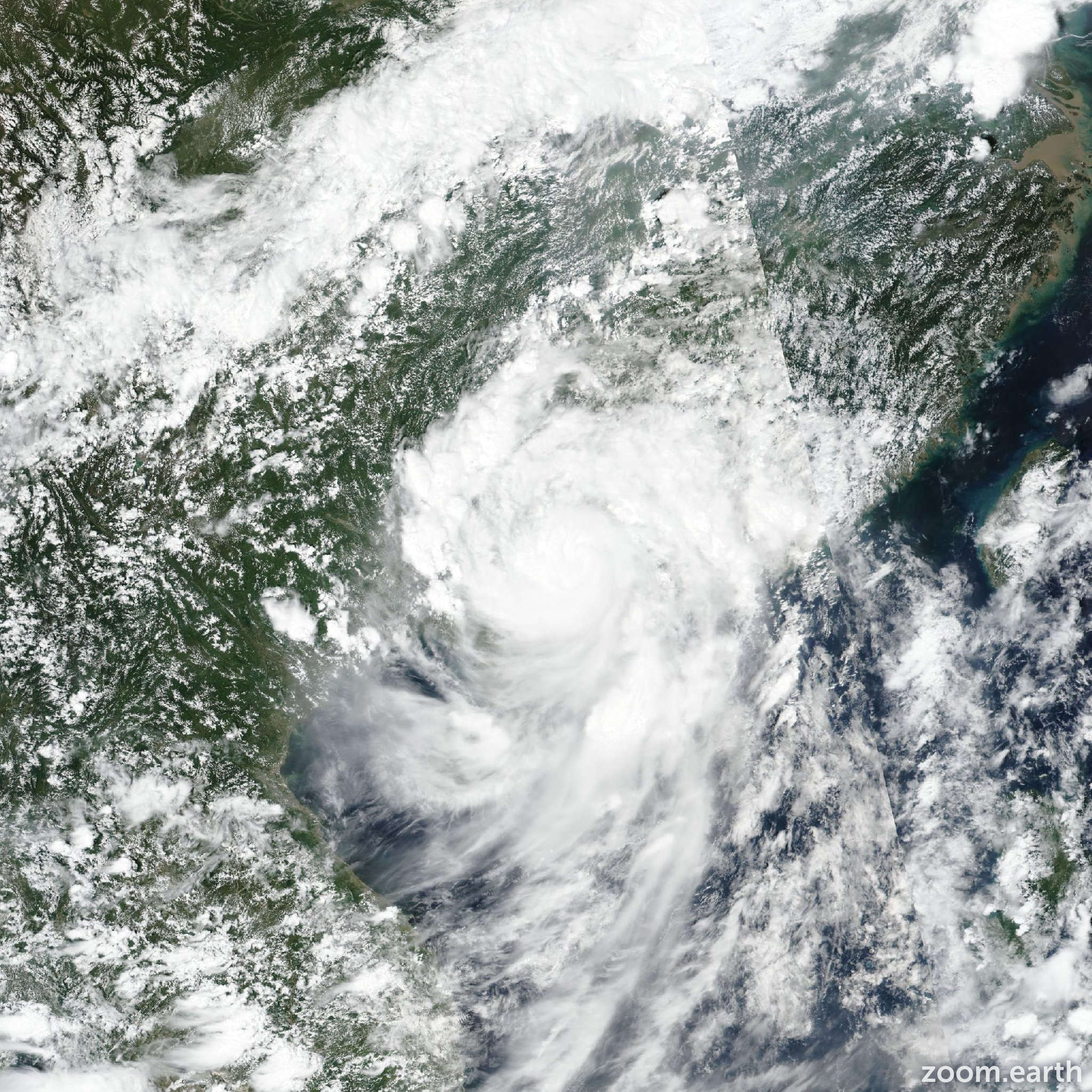
Live tracking map, satellite images and forecasts of Tapah 2025 (台風16号) over China. Current wind speed 85km/h. Max 120km/h.
Tapah (Philippine name Lannie) is located 174 km west-southwest of Hong Kong, and has tracked north-northwestward at 20 km/h (11 knots) over the past 6 hours. Minimum central pressure at 08/00:00 UTC is 984 hPa. Maximum significant wave height is 8.8 meters (29 feet).
Tapah was upgraded to typhoon strength (65 knots) coincident with landfall, based primarily upon the raw ADT and AiDT values of 105 km/h (58 knots) and 120 km/h (66 knots) respectively.
Based on radar analysis, the system made initial landfall over the Chuanshan islands around 23:00 UTC then moved the short distance to the mainland, making landfall near Xiaowan Bay at 00:00 UTC.
Three-hourly surface observations from shanchuan dao were of insufficient temporal resolution to detect the maximum winds associated with passage of the low-level circulation center (LLCC), however the pressure reading of 985 hPa at 00:00 UTC provided higher confidence to the initial mean sea-level pressure estimate of 983 hPa at landfall.
The system is expected to continue tracking towards the northwest, along the southwestern side of the steering ridge, for the duration of the forecast period.
Tapah will steadily weaken as it moves over the rugged terrain over southern China, ultimately dissipating within the next 24 to 36 hours.
This is the final warning on this system by JTWC. The system will be closely monitored for signs of regeneration.