Tropical Depression 20W 2026
Last Modified:
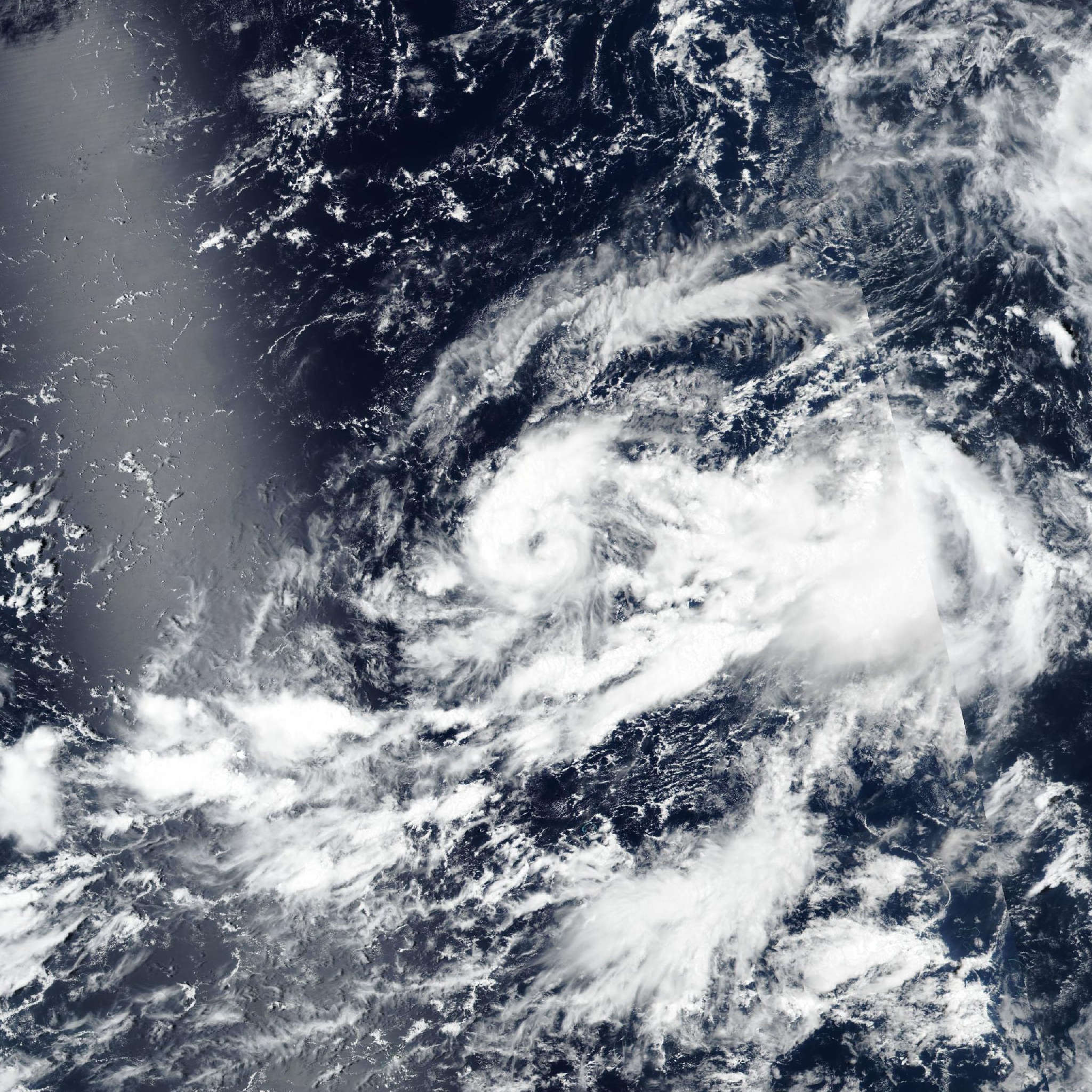
Live tracking map, satellite, radar, and forecasts of Tropical Depression 20W 2026 in the western Pacific Ocean. Current wind speed 55km/h. Max 85km/h.
20W is located 620 km west-southwest of Wake Island, and has tracked southeastward at 11 km/h (6 knots) over the past 6 hours. Maximum significant wave height is 3.7 meters (12 feet).
Going forward, the steering gradient is expected to rapidly shift from the west side of the circulation to the southern flank, along the northern edge of a band of strong southwesterly monsoonal winds which extends from Guam to east of 21W.
20W is already starting to turn eastward based on the latest satellite imagery frames, and this trend is expected to continue in the short-term, though some additional erratic motion is likely over the next few hours, especially if the recently developed convection can stick and the low-level circulation center attempts to align.
20W is forecast to turn gradually northeast, then north after 24 hours as it rides up the west side of an extension of the subtropical ridge which pushes southward along the dateline. At this point, the system will begin direct binary interaction with 21W, and is expected to be fully captured by 21W in 36 to 48 hours.
Once captured, 20W will follow in the lee of 21W and begin to embed within its wind field. Regarding intensity, 20W is currently 769 km southwest of 21W, far enough distant that the outflow associated with 21W is not directly impacting 20W yet.
Model fields suggest a reduction in shear in the near-term, which should allow for a period of intensification after 12 hours. 20W will however struggle with limited outflow aloft and the influence of dry air as well as bursts of outflow induced shear from 21W, which will inhibit development.
The peak of 85 km/h (45 knots) is expected to occur in around 2 days, by which point 20W will begin to be absorbed into 21W. The system quote dissipates unquote in 3 days as it is fully integrated into the wind field of 21W though it is expected to retain an asymmetric wind field of at least 55 km/h (30 knots) as it does so.
Track guidance is in poor agreement, though the exact values of cross-track spread become difficult to ascertain after 24 hours, as the models are beginning to jump circulations between 20W and 21W as they undergo binary interaction, capture and merger.
In general however, model spread between the GFS and NAVGEM opens up to at least 926 km in 3 days, with even higher spread between the NAVGEM and the EC-AIFS.
The bulk of the guidance however supports a gradual turn northward in the wake of 21W, including the ECMWF, which notably shifted track poleward though this may be an artifact of it jumping circulations.
The JTWC forecast is placed near the multi-model consensus mean, with very low confidence. Intensity guidance is suffering from the same issues of circulation jumping as the track guidance, which results in the models depicting a sharp intensification trend, which is extremely unlikely.
The HAFS-A seems to be the only model with a good handle on the overall situation, depicting some intensification followed by a gradual weakening before it too succumbs to the jumping trend.
The JTWC forecast is placed near the HAFS-A solution over the next 2 days then deviates sharply lower than all the guidance members, with low confidence.