Tropical Storm Podul 2025
Last Modified:
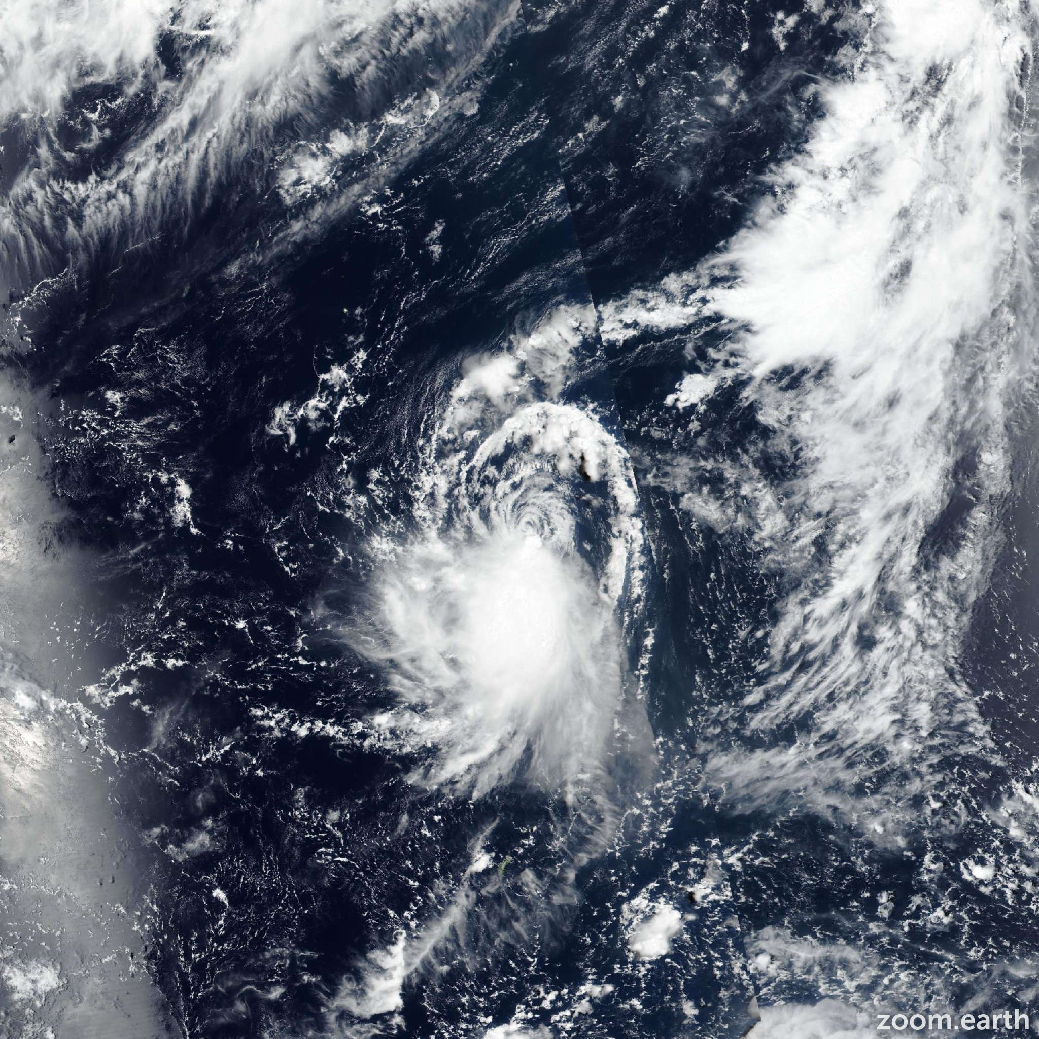
Live tracking map, satellite images and forecasts of Tropical Storm Podul 2025 (台風11号) south of Japan. Current wind speed 95km/h. Max 140km/h.
Podul is located 1630 km east-southeast of Kadena Air Base, and has tracked west-northwestward at 11 km/h (6 knots) over the past 6 hours. Maximum significant wave height is 6.7 meters (22 feet).
Podul will continue tracking west-northwest for another 24 hours and reach low typhoon strength before bending to a more westward track and reaching peak strength over the second 24 hour period.
A mid-to-high level ridge building along 160E will extend towards the Ryukyus, keeping the system well south of Okinawa. The harsh environment will slow development to a lower than climatological rate but the system will still manage to attain typhoon strength.
Rapid intensification and triple digit intensity is looking highly unlikely due to the high wind shear and dry air north of 20N. Okinawa and the northern senkakus are not quite off the hook yet as a poleward bend to the track still remains a possibility, but not a probability. In fact, the American ensemble (GFS) has joined some of the traditionally weaker trackers such as EGRR and agum, but even in the unlikely event of a track towards Okinawa, the environment along that track is so harsh that the storm would likely be dried out and sheared apart well before it made it that far.
The Taiwan-southern senkakus scenario remains much more likely, as the deep short wave currently tracking over Japan passes helps amplify the long wave pattern over the western Pacific.
As the pattern amplifies the bonin high will build a high amplitude ridge along the 165th meridian and expand towards Taiwan, with h500 heights exceeding 5900 meters all the way across Taiwan and into mainland China.
The point of divergence in the trackers comes after 135E, and until that issue is clarified, a minor threat exists to Okinawa. Podul is expected to begin a downtrend as it approaches 130E and decay rapidly due to high shear when it tracks into the East China Sea.
The JTWC track forecast runs equatorward of the multi model consensus favoring the ECMWF ensemble and some of the new, but impressive-so-far ai trackers.
Although cross-track spread increases after 3 days, all trackers follow the general trend of a westward run through 135E, then varying degrees of a poleward bend and a weakening trend thereafter.
Intensity guidance is also in good agreement showing a gradual uptrend through the next 2 days followed by a slow decline, then a rapid decline over the East China Sea.
The JTWC intensity forecast stays above the mid-line of guidance in anticipation of another surge during the pre-dawn hours tomorrow.