Tropical Cyclone Zazu 2020-2021

Last Modified:
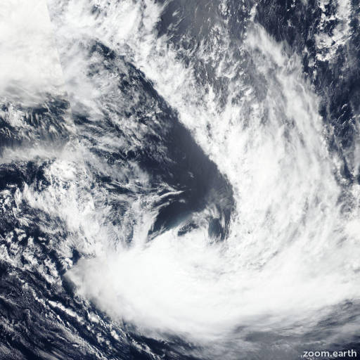
Satellite images, weather maps and tracks of Category 2 Tropical Cyclone Zazu 2020-2021, December 12 - 16. Max wind speed 100km/h.

Zazu is located 320 km (173 nautical miles) south-southeast of Niue, and has tracked east-southeastward at 28 km/h (15 knots) over the past 6 hours.

Satellite imagery reveals that Zazu has maintained its core convective structure despite strong westerly vertical wind shear. The initial position is placed with fair confidence based on the position of the LLCC in the satellite imagery loop.

Zazu is tracking along the western periphery of a subtropical ridge positioned to the east through a marginal environment with warm (26-27°C) sea surface temperatures and robust poleward outflow offset by high (50+ knots) vertical wind shear.

The system is currently undergoing extratropical transition (ETT) with strong westerly upper-level winds impinging on the western periphery of the system.

In 12 hours, Zazu will complete ETT as the system gains frontal characteristics and begins to interact with the upper-level jet. Forecast models are in good agreement and lends high confidence to the JTWC forecast track, placed on the multi-model consensus.

This is the final warning on this system by JTWC. The system will be closely monitored for signs of regeneration.

Maximum significant wave height at 16/06:00 UTC is 22 feet (6.7 meters).

Information provided by the Joint Typhoon Warning Center (JTWC).