Tropical Storm Yamaneko 2022

Last Modified:
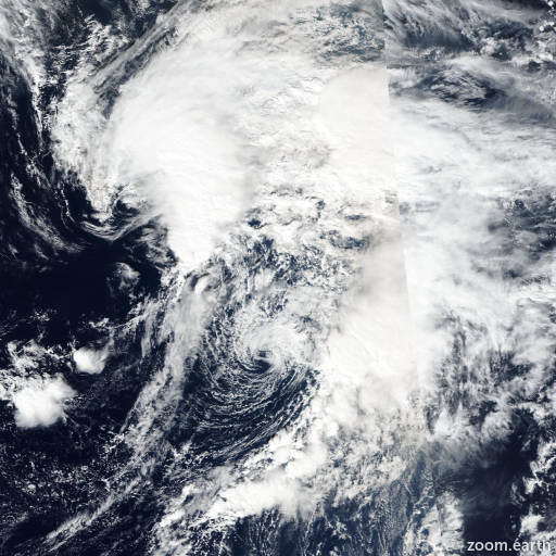
Satellite images, weather maps and tracks of Tropical Storm Yamaneko 2022, November 10 - 14. Max wind speed 65km/h.

Yamaneko is located 511 km north of Wake Island, and has moved north-northwestward at 19 km/h (10 knots) over the past 6 hours.

Satellite imagery continues to show the well developed but fully exposed low-level circulation center (LLCC) that is Yamaneko. Automated and manual phase classification worksheets show the system has transitioned to a fully subtropical depression, having characteristics of both a tropical and extratropical cyclone such as a moderate amount of thermal advection, warm sea surface temperatures, strong wind shear and associated with an upper-level trough.

The system is starting to pick up speed as it heads north along the southwestern side of an amplifying ridge to the east. A strong upper-level trough lies just to the west with an associated rapidly developing surface low lying near 30N 160E.

The initial position is assessed with high confidence based on the exposed LLCC. The initial intensity is also assessed with high confidence, in line with the bulk of the agency fixes, the aidt, deep micronet and open-aiir estimates.

While Yamaneko is currently assessed as subtropical, this phase will be short lived and the system will rapidly transition to an extratropical cyclone as it comes into phase with the negatively tilted trough moving in from the west, moves north of the 26°C isotherm and moves under a strong 200 hPa jet max.

The system is expected to intensify as it becomes extratropical due to the very strong baroclinic forcing and races off to the northeast.

This is the final warning on this system by JTWC. The system will be closely monitored for signs of regeneration.

Maximum significant wave height is 4.3 meters (14 feet).

Information provided by the Joint Typhoon Warning Center (JTWC).