Super Typhoon Usagi (Ofel) 2024
Last Modified:
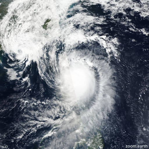
Live tracking map, satellite images and forecasts of Super Typhoon Usagi 2024 (台風25号) northeast of Luzon in the Philippines. Current wind speed 240km/h.
Usagi (Philippine name Ofel) is located 196 km southeast of Aparri, Philippines, and has tracked northwestward at 22 km/h (12 knots) over the past 6 hours. Maximum significant wave height is 15.8 meters (52 feet).
Usagi will continue to track northwestward as it begins to round the western rim of the steering subtropical ridge axis, clip the northeastern tip of Luzon just east of Aparri in around 6 hours then track into the Luzon Strait and more northward after 24 hours and crest the subtropical ridge axis.
A secondary subtropical ridge building in from the west near Hainan will compete for steering and slow down the storm motion, rendering the cyclone in a quasi-stationary mode in the col area between the two strs after 2 days, at best at a very slow northeastward progression off the southeastern coast of Taiwan.
The environment will become unfavorable and lead to a gradual weakening due to land interaction with Luzon and Taiwan, cooler sea surface temperatures and decreased ocean heat content due to upwelling in the col, and increased wind shear.
In 5 days, Usagi will be reduced to 85 km/h (45 knots). There is a distinct possibility that in around 36 to 48 hours, the secondary subtropical ridge will assume steering and drive the system southwestward toward the South China Sea (bifurcation scenario).
Forecast models are in tight agreement with a gradual and even spread to a mere 213 km at 36 hours; however, due to the potential bifurcation scenario proposed by a smaller strand of models including NVGM, GFS, and AEMN, the model envelope spreads out significantly and diametrically, lending overall medium confidence in the JTWC track forecast up to 3 days and low confidence afterward. Consequently, the confidences at both hours are the same for the intensity forecast.