Measure Distance

Measure Area

Click on the map to add points. Double‑click to finish.

Tap on the map to add points.

Tropical Storm Toraji (Nika) 2024

Last Modified:

Tropical Storm Toraji (Nika)

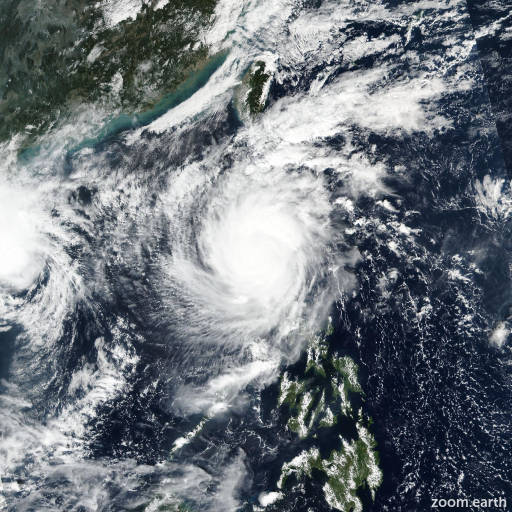
Live tracking map, satellite images and forecasts of Tropical Storm Toraji 2024 (台風23号) southeast of Hong Kong. Current wind speed 85km/h. Max 150km/h.

Toraji (Philippine name Nika) is located 394 km southeast of Hong Kong, and has tracked west-northwestward at 7 km/h (4 knots) over the past 6 hours. Maximum significant wave height is 6.7 meters (22 feet).

Toraji is forecast to continue tracking northwestward under the influence of a subtropical ridge to the northeast, however in 12 to 24 hours the steering will weaken, as the system moves away from the ridge. At that stage the dry air entrainment will cause further deterioration of the convective structure, amplified by the increasing southwesterly wind shear and cooling sea surface temperatures.

As the system shallows and weakens it will begin turning southwestward and eventually southward, weakening to wind speeds below the warning criteria in 3 days.

Model guidance is in fair agreement with majority of the models suggesting a gradual westward, southwestward and eventually southward turn. Only JMA and UKMET deterministic models are sticking to a more northwestward track, however JTWC forecast is laid close to the multi-model consensus.

As far as intensity guidance, JTWC forecast is hedged 10–20 km/h (5–10 knots) above the consensus members mean and leaning closer to the GFS and HWRF deterministic guidance, consistent with the assessed and forecast track.