Cyclonic Storm Tauktae 2021
Last Modified:
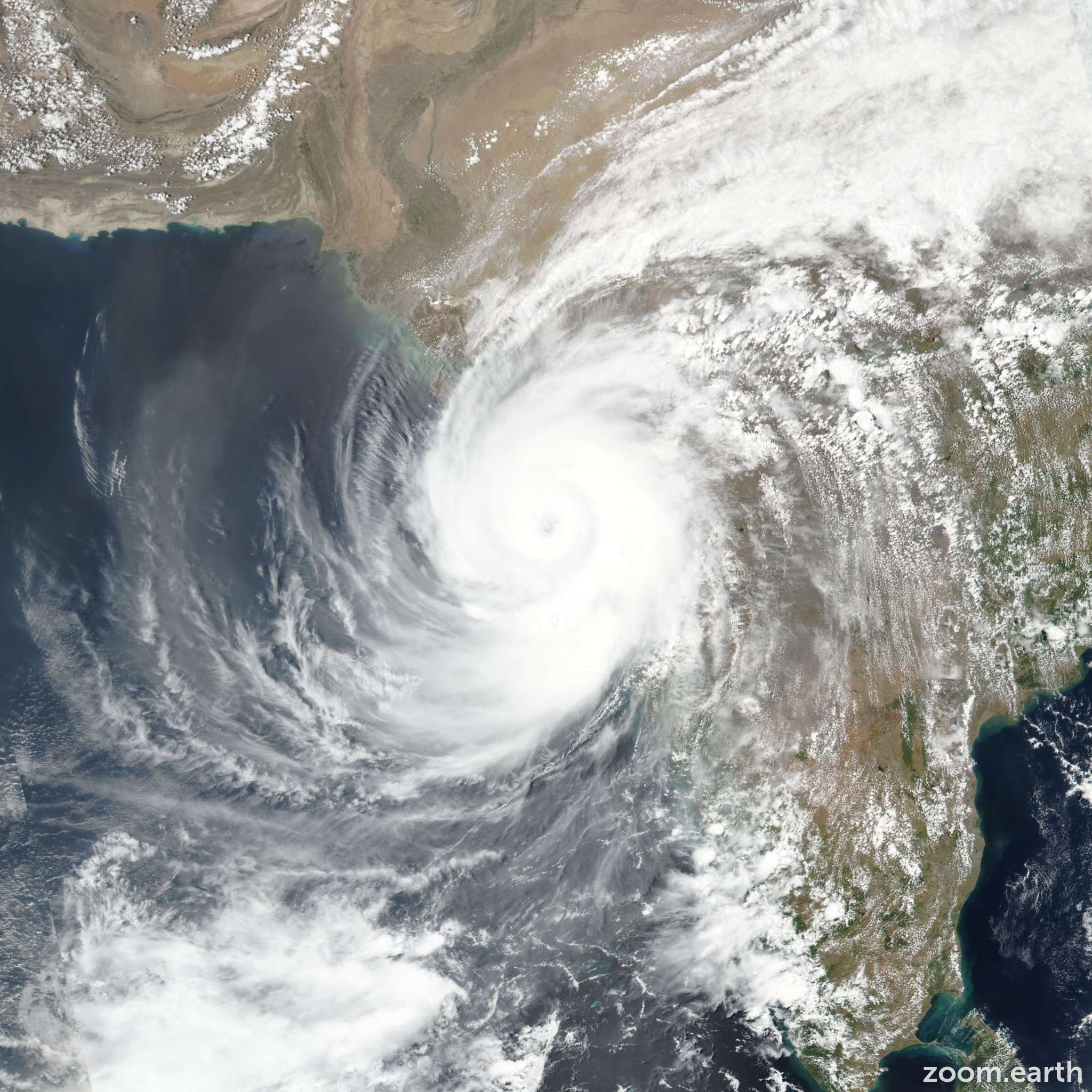
Satellite images, weather maps and tracks of Extremely Severe Cyclonic Storm Tauktae 2021, May 13 - 19. Max wind speed 220km/h.
Tauktae is located 259 km northwest of Mumbai, India, and has moved northward at 15 km/h (8 knots) over the past 6 hours.
Infrared imagery shows that Tauktae has become better organized just prior to landfall, with a 37 km eye feature, surrounded by a solid ring of cold cloud tops in the BD enhancement.
The system was in the process of crossing the shoreline at the 17/18:00 UTC hour, very near to Jafarabad, India. The initial position was placed with high confidence based on the 37 km eye feature in the infrared imagery loop.
The initial intensity is assessed at 205 km/h (110 knots) with moderate confidence, reflecting the improved infrared signature, colder cloud tops and warmer eye temperature.
The overall environment remains conducive, with low (10-15 knots) wind shear and good poleward outflow. Now that the system is over land however, it is expected to rapidly weaken due to the combination of land interaction and rapidly increasing wind shear as it tracks northeastward.
Significant southerly winds are still possible in the Gulf of Khambaht over the next 12 hours even though the system itself will be centered well inland.
Tauktae is forecast to fully dissipate as a tropical cyclone in 36 hours as it moves across the Aravalli mountains.
This is the final warning on this system by JTWC. The system will be closely monitored for signs of regeneration.
Maximum significant wave height is 11.6 meters (38 feet).
Information provided by the Joint Typhoon Warning Center (JTWC).