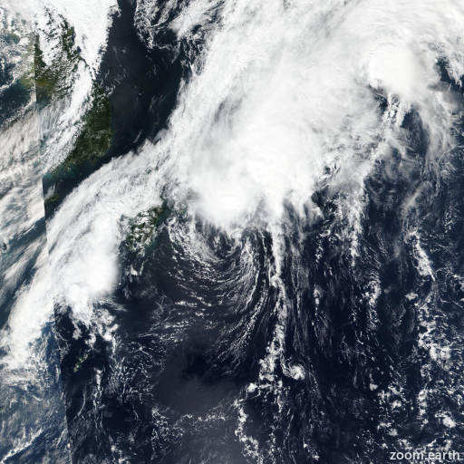
Tropical Depression Talas 2022
Last Modified:
Satellite images, weather maps and tracks of Tropical Depression Talas 2022, September 20 - 25. Max wind speed 55km/h.
Talas is located 267 km southwest of Yokosuka, Japan, and has moved east-northeastward at 17 km/h (9 knots) over the past 6 hours.
Satellite imagery shows that Talas was absorbed into the weak frontal boundary extending south of Honshu and has completely dissipated; there is no evidence of a distinct low-level circulation.
A scatterometer image shows a trough extending south from the Izu Peninsula with no closed circulation. Animated radar imagery shows several prominent rainbands flowing northward into the frontal boundary.
Model guidance shows another extra-tropical low (not Talas) will form along the frontal boundary over the Izu Peninsula and track eastward with little development over the next two days.
This is the final warning on this system by JTWC. The system will be closely monitored for signs of regeneration.
Maximum significant wave height is 3.7 meters (12 feet).
Information provided by the Joint Typhoon Warning Center (JTWC).