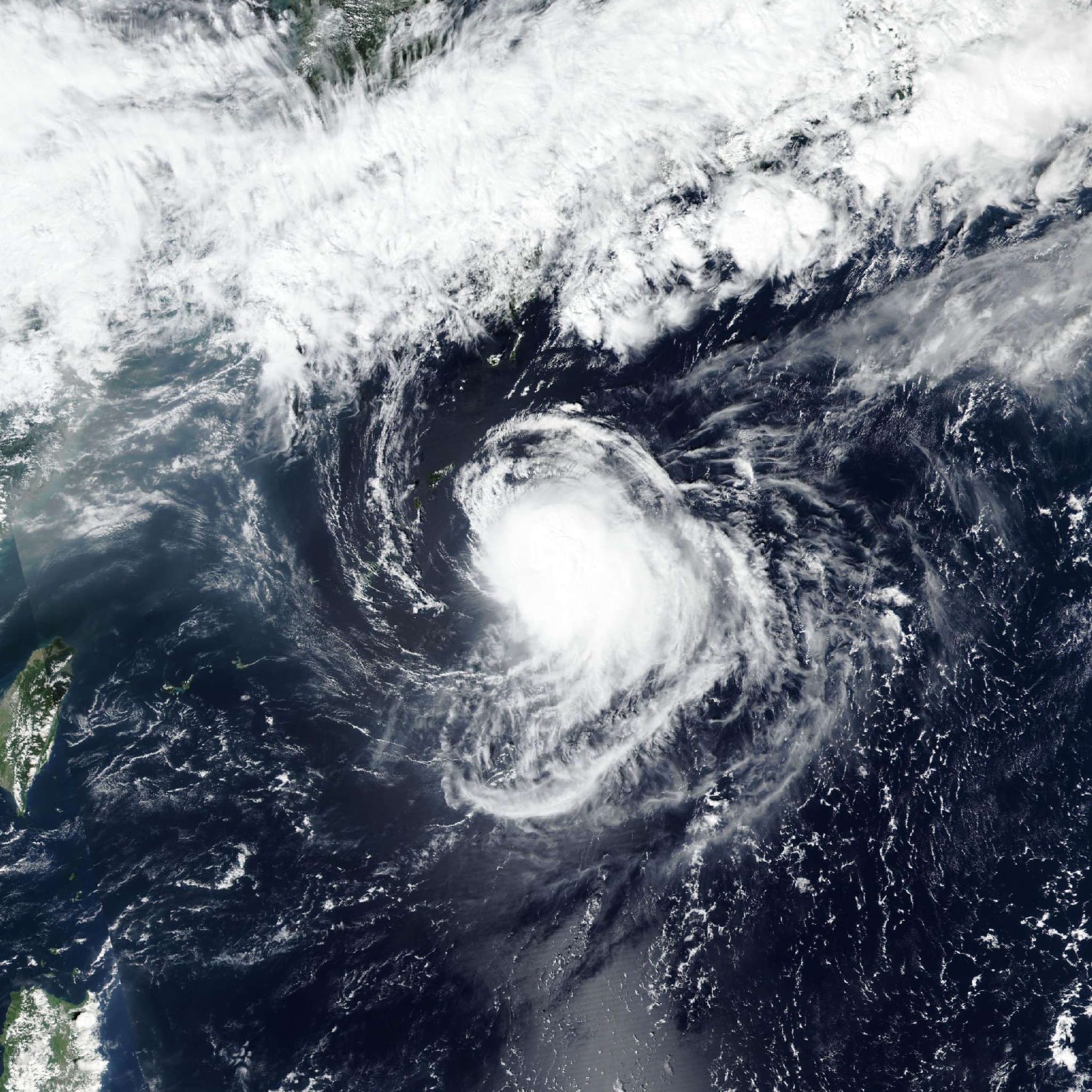
Tropical Storm Surigae (Queenie) 2026
Last Modified:
Live tracking map, satellite, radar, and forecasts of Tropical Storm Surigae 2026 (台風26号) in the Philippine Sea. Current wind speed 65km/h. Max 175km/h.
Surigae (Philippine name Queenie, Japanese Typhoon Number 26) is located 895 km south-southeast of Kadena Air Base, and has tracked northwestward at 19 km/h (10 knots) over the past 6 hours. Maximum significant wave height is 4.9 meters (16 feet).
Surigae has taken a slightly more northwestward jog over the last 6 hours than previously forecast, but is forecast to continue a general west-northwestward track at a steady rate for the next 24 hours.
After 24 hours, Surigae is forecast to slow in track speed and turn poleward as it approaches a weakness in the ridging between the primary steering subtropical ridge centered to the north-northeast and another subtropical ridge centered over southern China.
Surigae is expected to move slowly poleward until in around 3 days at which point it is forecast to turn northeastward and recurve the subtropical ridge to the east.
There remains uncertainty in the resultant track and track speed in this outcome as global model fields show varying steering environments during this time of recurvature in 2 to 4 days, both in regards to the disposition of the two strs, as well as the possible impacts of a mid-latitude shortwave trough propagating eastward.
The GFS model field shows the subtropical ridge to the east receding as well as the mid-lat trough without enough support to pull Surigae poleward and instead shows the system slowing in track speed and stalling just south of the Ryukyu Islands for the remainder of the forecast period.
Alternatively, the ECMWF and AI model fields assess the trough to have more dynamic support to bring Surigae poleward in around 3 days in conjunction with the eastern subtropical ridge maintaining stronger steering influence for the entirety of the forecast period, and is ultimately what is depicted in the official JTWC forecast track.
Regarding intensity, Surigae is forecast to gradually intensify over the next 24 hours as it axisymmetrizes, wind shear abates, and it improves in vertical structure.
In 1 to 2 days a period of rapid intensification (RI) is forecast as Surigae nears the axis of ridging and subsequent enhanced outflow. A peak of around 175 km/h (95 knots) is expected to occur in 60 hours to 3 days after this RI before a steady weakening phase begins due to increased wind shear and subsequent dry air entrainment.
There is also uncertainty with the intensity forecast due to it being highly dependent on the ultimate track of Surigae. The alternate scenario depicted by GFS could result in a higher peak intensity if Surigae remains in an area of more favorable conditions.
Track model guidance remains divided into three main groupings of a straight northwestward track for the remainder of the forecast period and two recurving scenarios with the remainder of physics-based models being markedely slower than the final group which is made up of the AI guidance and shows the quickest recurvature and northeastward track. This has resulted in a total along-track spread of 1296 km in 5 days between these three groups.
As discussed above, the official JTWC forecast track is laid in agreement with the steering scenario depicted by ECMWF and AI guidance in a recurvature scenario, closely in line with the multi-model and AI consensus track for the entirety of the forecast period and in line with the multi-model consensus track speed out over the next 3 days, then blending the track speeds of the multi-model and AI consensus in 3 to 5 days as they begin to diverge, with overall low confidence due to the large spread in guidance.
Model intensity guidance also remains split as the most reliable intensity aids show very different track outcomes with COAMPS-TC and HAFS-A stalling Surigae south of the Ryukyu Islands and thus depicting Surigae reaching near supertyphoon intensities, whereas the Google DeepMind shows an earlier and lower peak of 150 km/h (80 knots) as it tracks the system much more quickly through the recurvature. However, both AI and mesoscale ensemble intensity guidance continue to show support for RI to occur in 24 to 60 hours, lending some confidence to that portion of the forecast.
All guidance is in good agreement on a short term steady intensification prior to the possible RI, as well as agreement on a general weakening trend after 3 days, however the highest uncertainty remains with the timing and magnitude of peak intensity. As such, the official JTWC intensity forecast is assessed with low confidence throughout the forecast period, in good agreement with the multi-model consensus out over the next 2 days and then above it to better capture the expected RI period, coming back into agreement with the consensus in 4 days.