Measure Distance

Measure Area

Click on the map to add points. Double‑click to finish.

Tap on the map to add points.

Hurricane Rachel 2026

Last Modified:

Hurricane Rachel

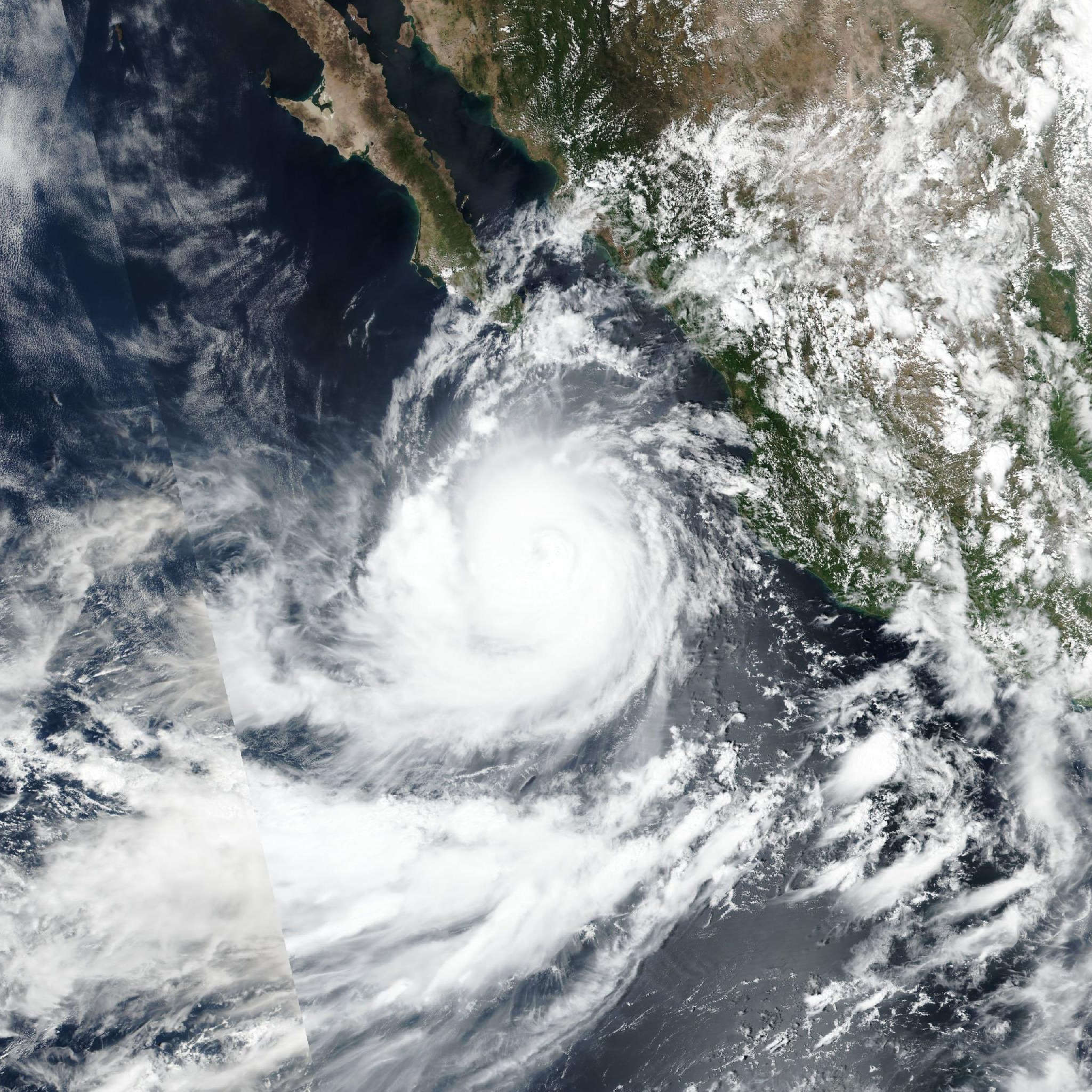
Live tracking map, satellite, radar, and forecasts of Hurricane Rachel 2026 near Mexico in the eastern Pacific Ocean. Current wind speed 85mph. Max 120mph.

Although the core of Rachel is forecast to remain offshore of Mexico, wind gusts of tropical-storm force are possible along portions of the coast of southwestern Mexico through tonight.

Outer bands from Rachel will continue to produce locally heavy rainfall across portions of coastal southwest Mexico. This rainfall may produce life-threatening flooding and mudslides, especially in areas of steep terrain.

Large waves could produce life-threatening surf and rip current conditions along the southwestern and west-central coast of Mexico and the southern Baja California Peninsula during the next several days.

Data from a NOAA Hurricane Hunter aircraft along with conventional and microwave satellite imagery shows that Rachel has been re-organizing for the past several hours. Microwave data near 13:00 UTC indicated that the cyclone had a ragged inner core with no organized eyewall. During the time that the aircraft has been in the storm, the eyewall has gotten better defined in the southeastern semicircle and the radius of maximum winds is getting smaller. The maximum 700-mb flight-level winds reported by the aircraft has been 95 mph (82 knots), and the central pressure is currently near 978 mb. Based mainly on the aircraft data, the initial intensity is held at 85 mph (75 knots). It should be noted that shear analyses show that the hurricane is still be affected by about 25 mph (20 knots) of northeasterly vertical wind shear.

The initial motion is still northwestward or 315/7 knots. Rachel continues to move along the southwestern side of a mid-tropospheric ridge over northern and central Mexico. This ridge is weakening due to the effects of a large mid- to upper-level trough seen in water vapor imagery over the southwestern United States and northwestern Mexico. As this trough moves northeastward and weakens during the next couple of days, this should allow another ridge to build to the north of the tropical cyclone. As a result, Rachel is forecast to turn west-northwest and pass well south of the Baja California Peninsula before continuing westward away from land. The new forecast track is a little to the north of the previous track for the first 60 hours, and thereafter is similar to the previous track.

Environmental conditions appear favorable for strengthening through at least 48 hours, and rapid strengthening is a possibility if the tighter inner core that Rachel is trying to develop maintains itself. Thus, the early portion of the intensity forecast keeps the same rate of intensification to a major hurricane as the previous forecasts. However, there remains two possible negative influences including the ongoing shear and Rachel crossing a track of cooler water left by Polo. Later on the forecast period, decreasing sea surface temperatures under the forecast track and dry air entrainment could cause some weakening. The new intensity forecast is again an update of the previous forecast, and it lies near the upper edge of the intensity guidance.