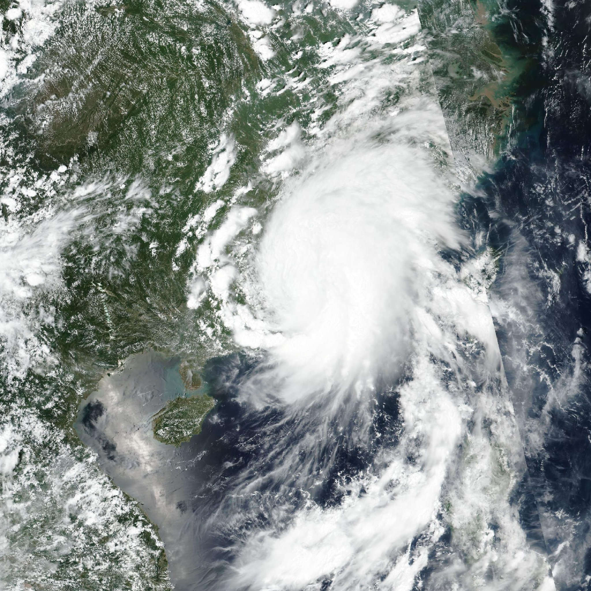
Tropical Storm Noul (Kiyapo) 2026
Last Modified:
Live tracking map, satellite, radar, and forecasts of Tropical Storm Noul 2026 (台風12号) northeast of Luzon in the Philippines. Current wind speed 65km/h. Max 150km/h.
Noul (Philippine name Kiyapo) is located 600 km northeast of Manila, Philippines, and has tracked west-northwestward at 28 km/h (15 knots) over the past 6 hours. Maximum significant wave height is 3.7 meters (12 feet).
Noul is being driven west-northwestward by a low- to mid-level ridge centered south of Honshu.
As the system intensifies, the deeper-layer ridge will become the dominant steering mechanism in 12 hours, maintaining the general northwest motion.
In 36 hours, the storm will begin to round the western edge of the subtropical ridge, turn poleward into southeast China, and maintain this trajectory until it dissipates inland.
The environment will be favorable for intensification, with the very warm waters of the Philippine Sea and the South China Sea supplying ample energy to the circulation. However, the system’s position along the southern edge of an upper-level ridge will impart persistent, low-to-moderate easterly wind shear throughout its lifecycle.
Despite the wind shear, the improving vertical alignment of the vortex will support a near-rapid rate of intensification over the next 12 hours. This strengthening will be modestly tempered by interaction with the terrain of northern Luzon.
After 24 hours, as Noul pulls away from land, a higher rate of intensification will commence. The forecast calls for Noul to peak at 150 km/h (80 knots) at landfall in around 2 days.
Once inland, the system will rapidly decay, leading to dissipation in 4 days. The model trackers present a tight envelope up to the point of landfall, with excellent along-track consensus.
NAVGEM is the poleward outlier. Excluding this solution, the cross-track spread among the remaining guidance is 185 km at 2 days. This spread is highlighted by GFS, which brings the system center to within 46 km of Hong Kong, while ECMWF is 185 km further east.
The JTWC track forecast largely follows the multi-model consensus with high confidence, hedged slightly towards the more southern solutions of HAFS-A and the experimental Google DeepMind over the next 3 days.
Virtually all reliable intensity aids show steady to rapid intensification over the next 2 days. Taking recent satellite trends into account, the JTWC intensity forecast calls for a 15-knots increase over the next 12 hours, followed by slightly slower development in 12 to 24 hours due to land interaction and a faster rate thereafter.
The forecast is set on the higher end of the guidance envelope but is below the 155–165 km/h (85–90 knots) peak predicted by DeepMind and COAMPS-TC.
The guidance suite rapidly weakens the system after landfall, showing complete dissipation in 4 days.