Tropical Cyclone Niran 2021
Last Modified:
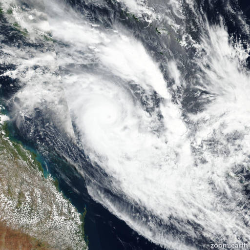
Satellite images, weather maps and tracks of Category 5 Tropical Cyclone Niran 2021, February 27 - March 7. Max wind speed 255km/h.
Niran is located 1059 km (572 nautical miles) south-southwest of Suva, Fiji, and has moved east-southeastward at 37 km/h (20 knots) over the past 6 hours.
Satellite imagery shows the system has become elongated and the low-level circulation center is now fully exposed. The initial position was placed with fair confidence using the aforementioned satellite imagery.
Analysis shows strong poleward outflow being offset by very strong (30-40 knots) wind shear and sea surface temperatures 24-25°C. The cyclone is moving along the southwest side of the deep layered subtropical ridge to the east.
The harsh upper level dynamics, along with the decreased sea surface temperatures, has decreased the system intensity over the past 6 hours as the system is undergoing subtropical transition and is expected to complete subtropical transition within the next 12 hours.
Forecast models are in fair agreement over the next 12 hours with only a 130 km (70 nautical miles) spread. There is high confidence in the first 12 hours of the forecast track and low confidence thereafter due to the increasing spread in model forecasts.
This is the final warning on this system by JTWC. The system will be closely monitored for signs of regeneration.
Maximum significant wave height is 8.2 meters (27 feet).
Information provided by the Joint Typhoon Warning Center (JTWC).