Severe Tropical Cyclone Narelle 2026
Last Modified:
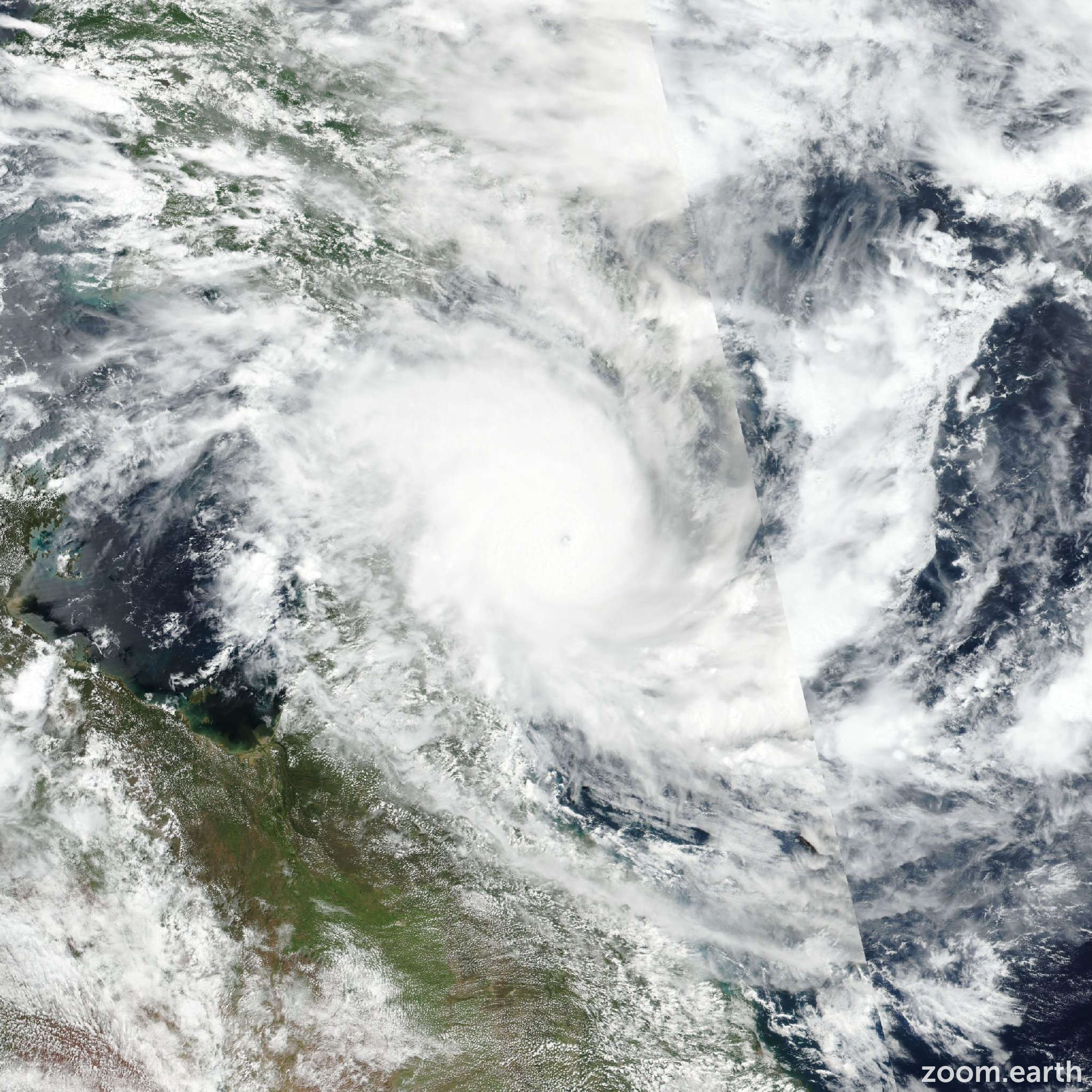
Live tracking map, satellite, radar, and forecasts of Severe Tropical Cyclone Narelle 2026 near Cape York Peninsula, Australia. Current wind speed 230km/h. Max 240km/h.
Narelle is located 369 km north of Cairns, Australia, and has tracked westward at 20 km/h (11 knots) over the past 6 hours. Maximum significant wave height is 11.9 meters (39 feet).
Narelle is forecasted to continue tracking generally westward through the next 3 days, along the northern edge of the deep-layer subtropical ridge centered over Western Australia. Following the next 3 days, the western-most extent of the subtropical ridge over Western Australia is forecasted to slightly weaken and retreat southeastward, allowing Narelle to begin tracking west-southwestward until the end of the forecast period.
In 5 days, Narelle is forecasted to track a few miles just north of adele island as the track begins to become southwestward. Regarding intensity, Narelle is forecasted to begin gradually weakening over the next 12 hours while making an initial landfall in 6 to 12 hours.
As the low-level circulation center tracks into north Queensland, Australia, surface intensities are expected to decrease toward 175 km/h (95 knots) as the system competes with land interaction and sustained moderate wind shear.
Following initial landfall, a reemergence over open water is forecasted in 12 to 24 hours in the eastern Gulf of Carpentaria with a relatively broad low-level circulation center.
As the system tracks westward, the broad low-level circulation center will slowly begin to wrap tightly and undergo a period of reintensification toward 150 km/h (80 knots) in 2 days. Following the next 2 days, a second landfall along the east coast of the Northern Territory is expected. During this period, gradual decay is forecasted due to additional frictional land impacts and wind shear over 30 km/h (15 knots).
As the system tracks westward over the Northern Territory, continued weakening is forecasted toward 100 km/h (55 knots) in 3 days, 194 km south-southeast of Darwin.
In around 84 hours, Narelle will reemerge over the Joseph Bonaparte Gulf; however, the short period over open water will limit considerable reintensification.
A few hours before 4 days, Narelle is expected to make a third landfall over the northern extreme of Western Australia as surface intensities continue to gradually decay to 85 km/h (45 knots).
In 4 to 5 days, Narelle will once again reemerge over open water, off the northwest coast of Western Australia. During this period, gradual reintensificaiton is forecasted toward 100 km/h (55 knots) in 5 days as the environment is expected to be favorable.
Model guidance continues to be in very good agreement throughout the forecast period, with an improving cross-track spread of 59 km my the next 3 days. Following the next 3 days, the cross-track spread is expected to increase to 202 km in 4 days as the GFS deterministic model tracks Narelle farther westward as the northern-most solution, while available artificial intelligence solutions characterize the southern-most track just north of rowley shoals.
The JTWC track forecast has been placed very close to the JTWC multi-model consensus with high confidence, which lies squarely between GFS and the available Google DeepMind solution.
Regarding intensity, all available guidance illustrates a weakening phase until the next 24 hours. Following the next 24 hours, all intensity solutions are becoming increasingly aligned during the systems trek across multiple landmasses and regions of open water, with COAMPS-TC remaining as the only outlier during the expected track in the western Gulf of Carpentaria. Therefore, the JTWC intensity forecast has been assessed with medium confidence throughout the forecast period and placed just above the JTWC multi-model intensity consensus.