Measure Distance

Measure Area

Click on the map to add points. Double‑click to finish.

Tap on the map to add points.

Tropical Storm Nangka 2026

Last Modified:
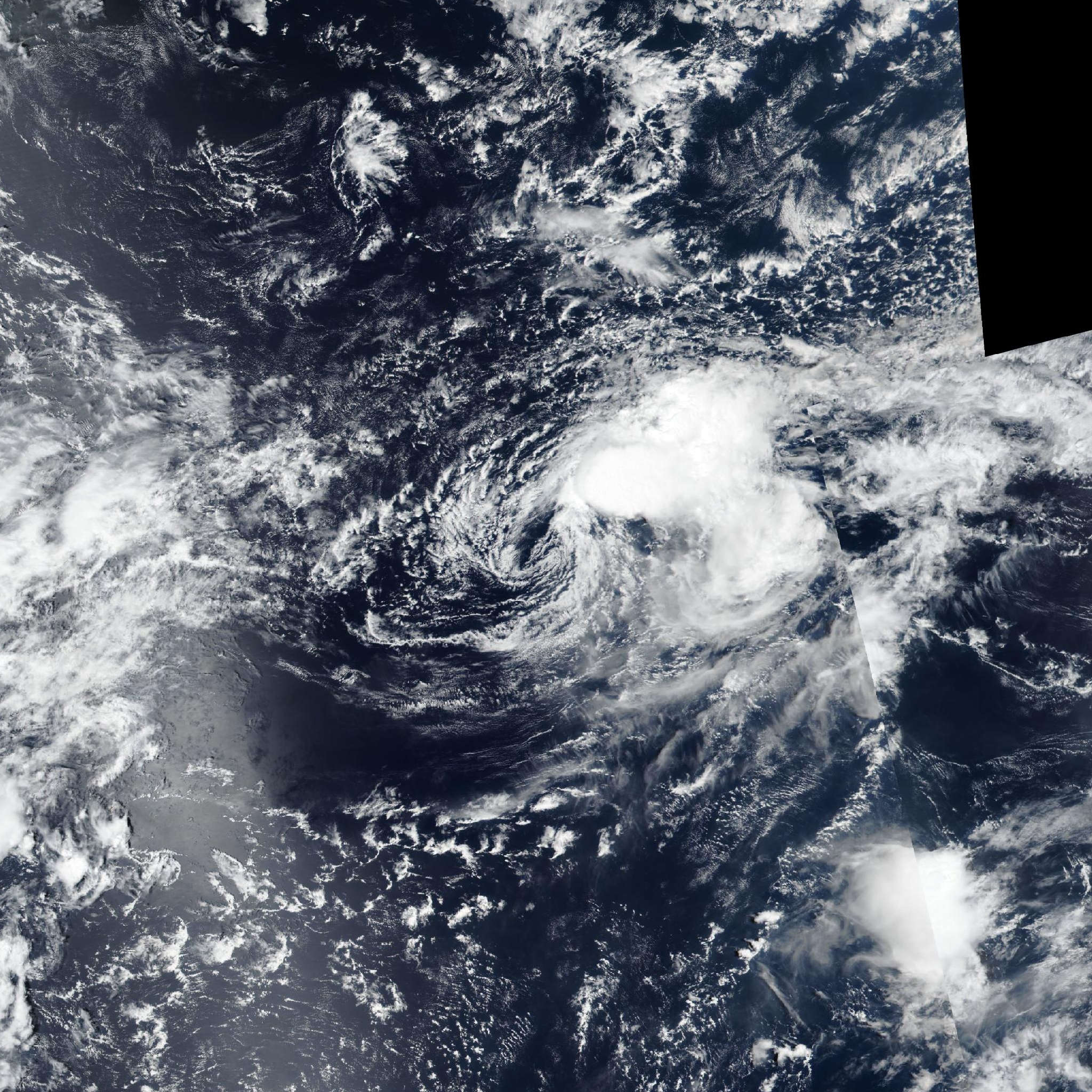
Tropical Storm Nangka

Live tracking map, satellite, radar, and forecasts of Tropical Storm Nangka 2026 (台風17号) in the western Pacific Ocean. Current wind speed 65km/h.

Nangka (Japanese Typhoon Number 17) is located 919 km east-northeast of Iwo To, and has tracked northeastward at 39 km/h (21 knots) over the past 6 hours. Maximum significant wave height is 4 meters (13 feet).

The steering pattern continues to evolve and remains highly uncertain. The GFS, representing the bulk of the physics-based dynamic models, shows an extension of the near-equatorial ridge building northward along 160E, while simultaneously a subtropical ridge builds southeastward, ultimately merging into one north-south oriented ridge complex positioned east of Nangka. This results in the bulk of the dynamic models turning the system north, then northwest after 12 hours.

The ECMWF, representing the bulk of the AI-based models, shows roughly the same overall evolution of the steering pattern, only delayed by about 24 hours, which allows Nangka to continue tracking eastward for longer before entering a weak and competing steering regime by the end of the forecast.

The experimental JTWC super-ensemble is also showing a bifurcated track envelope, with half of the members tracking northward, and the other half moving eastward after 12 hours, though of note, the ECEPS mean has now joined the eastward-moving group.

In light of the recent shift in the ECEPS and ECMWF, Nangka is forecast to continue tracking northeastward through the entirety of the forecast period.

Track speeds will begin to decrease sharply after 12 hours, as the system moves into a weak and competing steering environment. Regarding intensity, the system will likely begin a rapid vortex decoupling within the next 12 to 18 hours due to strong southwesterly shear and influx of dry mid-level air.

After decoupling, the system will steadily weaken and ultimately dissipate in 2 days. Track guidance shows an extreme amount of uncertainty, with the consensus package diverging to a 1111 km cross-track spread in 2 days.

The northwestward group consists of NAVGEM, JGSM, UKMET ensemble, GFS, and GEFS. On the other end of the envelope are Google DeepMind, EC-AIFS, ECMWF, ECEPS, and the JTWC experimental AI consensus mean along with multiple GFS AI-variants.

As discussed above, analysis suggests the eastward tracking group is gaining traction, with some major models shifting sides with this run. Lastly, a track density analysis of the super-ensemble members suggests a focus on an eastward track, lending higher confidence to the JTWC forecast track.

Intensity guidance is in good agreement, but maintains the system at a higher intensity for longer than the JTWC forecast, and does not reflect dissipation until much later. However, based on the marginal environment, anticipated dry air intrusion and vortex decoupling and fragile nature of the core due to its small size, the JTWC forecast deviates from the guidance, though confidence remains medium.