Tropical Storm Namtheun 2021
Last Modified:
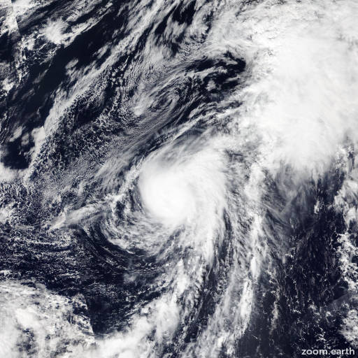
Satellite images, weather maps and tracks of Severe Tropical Storm Namtheun 2021, October 8 - 18. Max wind speed 100km/h.
Namtheun is located 1724 km north of Wake Island, and has moved north-northeastward at 20 km/h (11 knots) over the past 6 hours.
Namtheun is forecast to recurve and accelerate northeastward through the forecast period with extra-tropical transition (ETT) completing by 18/00:00 UTC as the system gains frontal characteristics and tracks near a midlatitude jet.
Namtheun is expected to slowly weaken as it tracks over cooler sea surface temperatures (20-22°C) with increasing entrainment of cooler, drier, more stable air.
There is a possibility the system may weaken below tropical depression strength prior to completing ETT. Forecast guidance remains in good agreement through the forecast period with a 120 km spread in solutions at 24 hours, lending high confidence to the JTWC forecast track.
Intensity guidance shows a range of intensity values from 45-75 km/h (25-40 knots) through the forecast period lending medium confidence to the JTWC intensity forecast.
Maximum significant wave height is 5.2 meters (17 feet).
Information provided by the Joint Typhoon Warning Center (JTWC).