Typhoon Nalgae (Paeng) 2022

Last Modified:
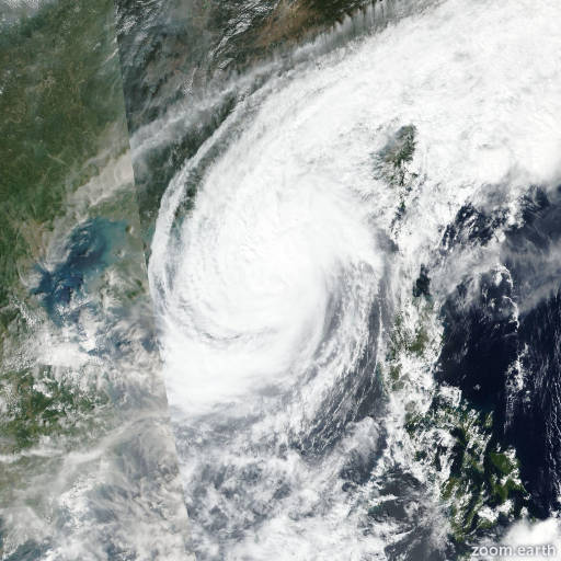
Satellite images, weather maps and tracks of Typhoon Nalgae 2022, October 24 - November 3. Max wind speed 130km/h.

Nalgae (Philippine name Paeng) is located 135 km west of Hong Kong, and has moved west-northwestward at 17 km/h (9 knots) over the past 6 hours.

Satellite imagery and animated radar imagery from Hong Kong show a very shallow and weak low-level circulation center (LLCC) moving inland to the west of shenzen.

The system has rapidly weakened and filled, with pressure readings from the region showing a minimum pressure of 1012 hPa. The initial position is assessed with high confidence based on the radar and satellite imagery depictions.

The initial intensity is also assessed with high confidence based on a CIMSS open-aiir intensity estimate of 45 km/h (25 knots). The system is expected to slowly drift towards the west and ultimately southwest over the next 24 hours while continuing to weaken. However, it is possible that the shallow remnant circulation could potentially remain quasi-stationary in the guangshou basin as it undergoes dissipation.

This is the final warning on this system by JTWC. The system will be closely monitored for signs of regeneration.

Information provided by the Joint Typhoon Warning Center (JTWC).