Cyclonic Storm Murasu 2026
Last Modified:
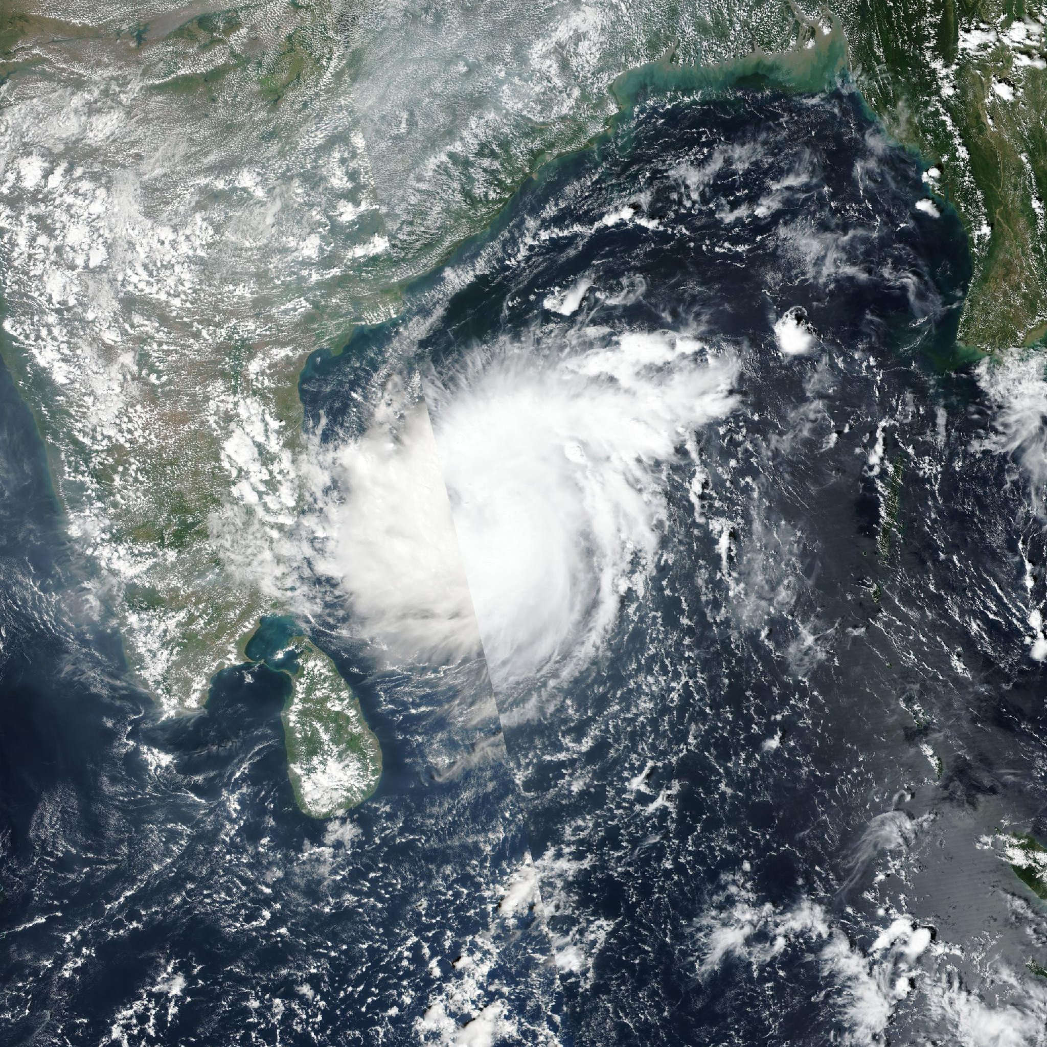
Live tracking map, satellite, radar, and forecasts of Cyclonic Storm Murasu 2026 in the Bay of Bengal. Current wind speed 120km/h.
Murasu is located 1215 km southwest of Kolkata, India, and has tracked northwestward at 13 km/h (7 knots) over the past 6 hours. Maximum significant wave height is 7.3 meters (24 feet).
Over the next 12 to 18 hours, as this ridge bifurcation amplifies, the western edge of the eastern anticyclonic cell will reorient along a more meridional (north-south) axis, steering Murasu onto a more north-northwestward trajectory.
Translation speeds will remain quasi-stationary to slow, and Murasu could briefly stall immediately offshore before drifting inland while embedded within the weak-steering col region. Landfall is currently forecast to occur in around 12 hours, though a further meridional track deflection or additional deceleration could delay and shift the landfall location further north along the coastline.
Post-landfall, Murasu will advect slowly northward before recurving sharply westward by the end of the forecast period as the shallowing vortex decouples aloft and becomes governed by progressively lower-tropospheric steering flow.
Regarding intensity, further intensification is unlikely; although synoptic upper-level and oceanic conditions remain favorable, encroachment on the Indian coastline will induce continental dry air entrainment within the boundary layer along the western semicircle of the inner core. Additionally, coastal deceleration over shallow shelf waters will induce localized oceanic upwelling of cooler nearshore waters, depriving the vortex of the surface heat fluxes required to sustain intensification.
Following landfall, Murasu will rapidly spin down due to surface frictional dissipation and topographic disruption, completely dissipating over eastern India in 2 days.
Track guidance is in good overall agreement, though the majority of the multi-model guidance suite fails to resolve the subtle meridional trajectory deflection.
Only the deterministic GFS, Google DeepMind (GDM), HAFS-A, and HWRF capture this poleward curvature, whereas the remainder of the guidance suite maintains a linear northwestward trajectory prior to recurving westward in 2 days.
The official JTWC track forecast is aligned closely with the GFS and HAFS-A solutions, with medium confidence. Intensity guidance is in tight agreement, with only the statistical-dynamical SHIPS-GFS indicating modest intensification prior to landfall, while the remainder of the intensity guidance suite shows immediate weakening.
The official JTWC intensity forecast is positioned 10 km/h (5 knots) above the multi-model intensity consensus (ICNW) through the forecast period with high confidence.