Tropical Storm Lupit (Huaning) 2021
Last Modified:
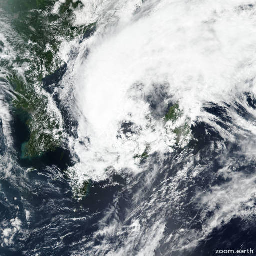
Satellite images, weather maps and tracks of Tropical Storm Lupit 2021, August 2 - 10. Max wind speed 85km/h.
Lupit (Philippine name Huaning) is located 356 km northwest of Yokota Air Base, Japan, and has moved northeastward at 26 km/h (14 knots) over the past 6 hours.
Lupit will continue to track northeastward in the Sea of Japan under the steering influence of the subtropical ridge and cross northern Honshu just south of Misawa then exit back into the Pacific Ocean just after 12 hours.
The marginally favorable environment will favor a slight intensification to 85 km/h (45 knots) between 1 and 2 days. Also in 24 hours, the system will begin extra-tropical transition and transform into a gale-force cold core low with an expansive wind field in 2 days.
Forecast guidance are in tight agreement with a gradual and even spread to just 154 km in 2 days, lending high confidence in the JTWC track forecast. However, given the uncertainties of extra-tropical transition, the level of confidence in the JTWC intensity forecast is overall a medium.
Maximum significant wave height is 4 meters (13 feet).
Information provided by the Joint Typhoon Warning Center (JTWC).