Tropical Cyclone Lucas 2021

Last Modified:
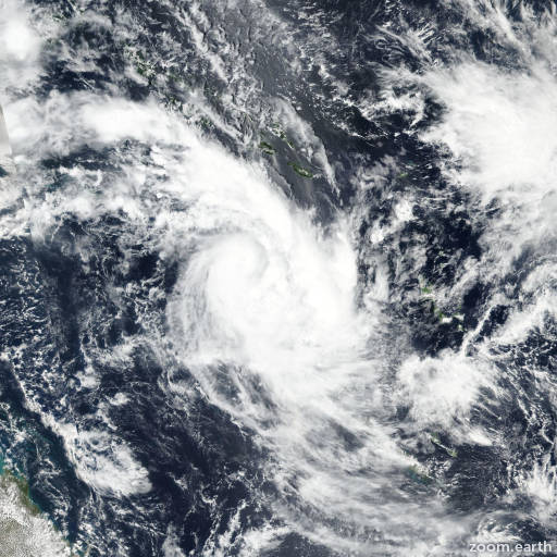
Satellite images, weather maps and tracks of Category 2 Tropical Cyclone Lucas 2021, January 25 - February 4. Max wind speed 120km/h.

Lucas is located 106 km (57 nautical miles) east-northeast of Noumea, New Caledonia, and has tracked southward at 24 km/h (13 knots) over the past 6 hours.

Satellite imagery shows the central convection remains sheared southward partly exposing the low level circulation (LLC). The satellite imagery loop also shows vigorous cold air advection as evidenced by stratocumulus cloud lines wrapping into the LLC.

The initial position is placed with high confidence based on the partly exposed LLC in the satellite imagery loop, and lined up with a defined LLC feature in the ASCAT bullseye pass.

Cyclone phase analysis indicates Lucas is quickly becoming subtropical and will complete subtropical transition in 12 hours. As such, the system no longer meets the JTWC warning criteria.

This is the final warning on this system by JTWC. The system will be closely monitored forsigns of regeneration.

Maximum significant wave height is 4.3 meters (14 feet).

Information provided by the Joint Typhoon Warning Center (JTWC).