Typhoon Kulap 2022
Last Modified:
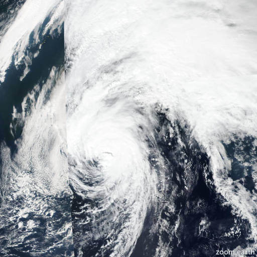
Satellite images, weather maps and tracks of Typhoon Kulap 2022, September 25 - 29. Max wind speed 120km/h.
Kulap is located 1117 km east-southeast of Misawa, Japan, and has moved northeastward at 52 km/h (28 knots) over the past 6 hours.
Kulap is embedded within the midlatitude westerlies, under the jet with strong wind shear. Model analysis data shows a frontal structure with thickness packing and cold air advection over the western semicircle; a weak cold front is evident in enhanced infrared satellite imagery.
Core structure in infrared imagery, however, has persisted with a large eye now broadening with warming cloud top temperatures. The system has thus far been able to cocoon itself from the hostile environment due to strong poleward outflow and warm sea surface temperatures.
An AMSR2 windspeed image shows an asymmetric windfield with 120-130 km/h winds (65-70 knots) over the eastern quadrant and extensive gale-force winds over the southern semicircle.
Kulap is forecast to rapidly complete extra-tropical transition over the next 12 hours as it occludes and accelerates northeastward over cold water (less than 20°C). However, the system will maintain typhoon-strength winds as it approaches the aleutian island chain.
This is the final warning on this system by JTWC. The system will be closely monitored for signs of regeneration.
Maximum significant wave height is 12.2 meters (40 feet).
Information provided by the Joint Typhoon Warning Center (JTWC).