Tropical Depression Krovanh (Vicky) 2020

Last Modified:
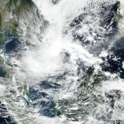
Satellite images, weather maps and tracks of Tropical Depression Krovanh 2020, December 17 - 25. Max wind speed 55km/h.

Tropical Depression Krovanh (Philippine name Vicky) is located 493 km (266 nautical miles) southeast of Ho Chi Minh City, Vietnam, and has tracked westward at 11 km/h (6 knots) over the past 6 hours.

Infrared satellite imagery shows fragmented and flaring convection sheared approximately 90 nautical miles northwest of a weak, ragged, elongated, and partially exposed low level circulation (LLC).

The initial position is placed with fair confidence based on the LLC in the infrared imagery loop that lined up well with a ragged but defined LLC in the AMSU microwave image.

The initial intensity of 45 km/h (25 knots), classified as too weak by PGTW, is based on surface wind and sea level pressure observations from Huyen Tran island, 55 nautical miles to the east-northeast.

A narrow swath of elevated 30-35 knot winds to the northwest associated with convergence induced by a wind surge in the South China Sea and compressed along the Vietnamese coast are under the sheared convection.

Krovanh is expected to track westward along the southern periphery of the low-level subtropical ridge to the northwest and is forecast to gradually weaken as it tracks into increasing wind shear and diminishing upper level outflow, leading to dissipation in 12 hours.

Numerical models are in good agreement lending fair confidence in the JTWC track forecast. This is the final warning on this system by JTWC. The system will be closely monitored for signs of regeneration.

Maximum significant wave height at 22/12:00 UTC is 13 feet (4 meters).

Information provided by the Joint Typhoon Warning Center (JTWC).