Tropical Cyclone Kimi 2021

Last Modified:
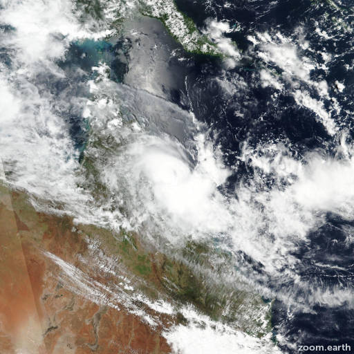
Satellite images, weather maps and tracks of Category 2 Tropical Cyclone Kimi 2021, January 15 - 19. Max wind speed 100km/h.

Kimi is located 191 km (103 nautical miles) east-southeast of Cairns, Australia, and has tracked northwestward at 2 km/h (1 knot) over the past 6 hours.

Infrared satellite imagery shows the system continuing to unravel as the associated convection has sheared further southeastward from the ragged low level circulation (LLC) that has become quasi-stationary.

The initial position is placed with fair confidence based on the infrared imagery animation, composite radar loops, and triangulation from nearby surface observations.

Analysis indicates the system is under relative vertical wind shear of 25 knot+ with upper level winds diametrically against the low level southerly winds, resulting in a decoupling of the LLC.

Although there is moderate poleward upper level outflow and warm sea surface temperatures (29°C), the system is not expected to re-consolidate, leading to dissipation in 12 hours.

The remnants of Kimi will likely drift northward with the low level wind flow.

This is the final warning on this system by JTWC. The system will be closely monitored for signs of regeneration.

Maximum significant wave height at 18/18:00 UTC is 12 feet (3.7 meters).

Information provided by the Joint Typhoon Warning Center (JTWC).