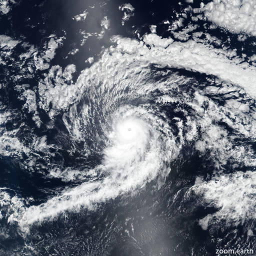
Hurricane Kiko 2025
Last Modified:

Live tracking map, satellite images and forecasts of Hurricane Kiko 2025 in the eastern Pacific Ocean. Current wind speed 100mph. Max 115mph.
The eye of Kiko continues to gradually become better defined on visible and infrared GOES-18 imagery. While the TAFB and SAB Dvorak estimates of 4.5 (77 knots) and 5.0 (90 knots) are unchanged from 6 hours ago, the objective intensity estimates from UW-CIMSS have increased, and now range from 70–85 knots. The latest SATCON and AiDT measurements are both 95 mph (83 knots), and the eye has continued to warm and become better defined over the past couple of hours. The initial intensity is increased to 100 mph (85 knots) for this advisory.
Kiko continues moving slowly westward, or 270 degrees at 5 mph (5 knots). The main steering feature continues to be the subtropical ridge located to the north of Kiko. A slow westward motion should continue for the next couple of days. A turn toward the west-northwest is forecast by days 3 and 4 as an upper-level trough north of Hawaii begins to erode the western portion of the subtropical ridge. There remains above normal along-track spread in the model suite. The latest NHC track forecast was sped up a bit from the previous official forecast, and is relatively close to, but slightly slower than, the latest TVCE consensus and GFEX.
Through the next 48 hours, Kiko should remain over sea-surface temperatures of 27–28°C, with light to moderate easterly wind shear, but the relatively dry and stable environment is making the intensity forecast tricky. There is larger than normal spread among the various intensity models. Between days 3 and 4, water temperatures along Kiko's path will begin to decrease while it also moves into a progressively drier air mass. The NHC intensity forecast continues to lie at the high end of the guidance suite through day 3, but is now close to the middle of guidance envelope at days 4 and 5.