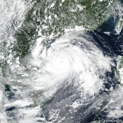
Typhoon Kajiki 2025
Last Modified:

Live tracking map, satellite images and forecasts of Typhoon Kajiki 2025 (台風13号) near Vietnam. Current wind speed 165km/h. Max 175km/h.
Kajiki (Philippine name Isang) is located 270 km north-northwest of Da Nang, Vietnam, and has tracked westward at 20 km/h (11 knots) over the past 6 hours. Maximum significant wave height is 9.8 meters (32 feet).
Kajiki will continue westward over the next 12 hours while under the steering influence of the subtropical ridge to the north. During this time, Kajiki will make landfall on the east coast of Vietnam.
The environment will be less favorable as the system tracks over the southern Gulf of Tonkin due to significant upwelling of cool water. The wind shear will remain favorably low and the upper-level environment will remain favorably divergent.
Once Kajiki makes landfall, topographic interaction will cause the system to rapidly weaken to dissipation in 36 hours. Deterministic model guidance is in strong agreement that Kajiki will move westward for the remainder of the forecast period.
The cross-track spread in 36 hours is 96 km.
The intensity guidance is in strong agreement as well forecasting rapid weakening for the next 36 hours.