Tropical Storm Joshua 2021

Last Modified:
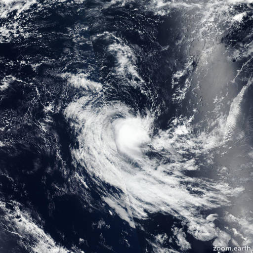
Satellite images, weather maps and tracks of Moderate Tropical Storm Joshua 2021, January 13 - 19. Max wind speed 95km/h.

Joshua is located 1906 km (1029 nautical miles) southeast of Diego Garcia, and has tracked west-southwestward at 20 km/h (11 knots) over the past 6 hours.

Infrared satellite imagery shows the central convection has significantly eroded and sheared 130+ nautical miles southeastward from a ragged and fully exposed low level circulation (LLC).

The initial position is based on the LLC in the infrared imagery loop with high confidence. As such, this is the final warning on this system by JTWC. The system will be closely monitored for signs of regeneration.

Maximum significant wave height at 19/00:00 UTC is 12 feet (3.7 meters).

Information provided by the Joint Typhoon Warning Center (JTWC).