Tropical Depression Jangmi (Domeng) 2026
Last Modified:
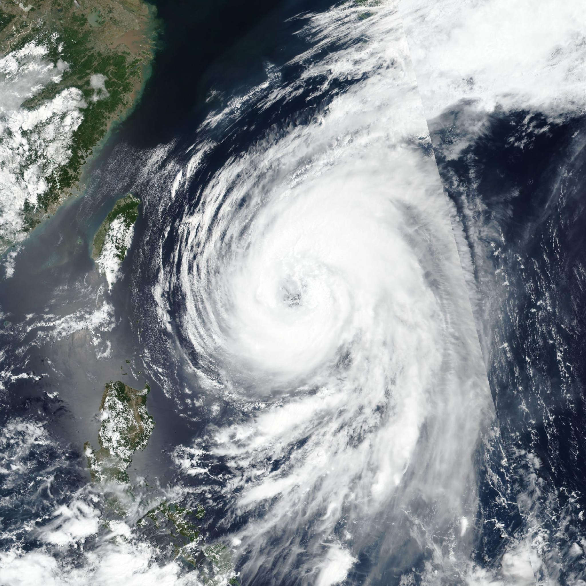
Live tracking map, satellite, radar, and forecasts of Tropical Depression Jangmi 2026 near Yap, Micronesia. Current wind speed 45km/h. Max 165km/h.
Jangmi (Philippine name Domeng) is located 133 km northwest of Yap, and has tracked north-northwestward at 13 km/h (7 knots) over the past 6 hours. Maximum significant wave height is 3.4 meters (11 feet).
Jangmi is currently being driven north-northwestward along the western boundary of a low- to mid-level subtropical ridge centered to the south of Guam.
As Jangmi continues to intensify, the subtropical ridge will build and expand northward in response, developing into a north-south oriented ridge with an axis along the Marianas island chain.
In 36 hours, the subtropical ridge to the east is forecast to reorient to a more northwest-southeast axis and continues to build, while a second subtropical ridge over southeastern China recedes westward, inducing a weakness in the steering pattern in the vicinity of Okinawa.
Jangmi will turn onto a northwestward trajectory in 1.5 to 3 days, driven along the western flank of the subtropical ridge to the east and towards the orographically assisted weakness in the ridging pattern.
In 3 days, a mid-latitude trough will move eastward across Korea, deepening the weakness in the ridge near Okinawa while simultaneously shifting the subtropical ridge further east. This will allow Jangmi to begin to recurve, approaching the ridge axis in 5 days.
The primary driver of track variance during this phase of the forecast is the timing and amplitude of the trough passage. The ECMWF shows a stronger, deeper trough, which results in accelerated recurvature and track speed after 4 days.
Conversely, the GFS shows a weaker trough, with a resulting slower track that delays recurvature by approximately 12 hours and extends further west, resulting in a direct impact on Okinawa.
Regarding intensity, the system remains disorganized with a vertically misaligned vortex. The mesoscale models suggest it will take 24 to 36 hours for the vortex to achieve vertical alignment. During this window, the system is expected to intensify at the climatological rate of one T-number per day, forecast to reach 65 km/h (35 knots) in 24 hours. Then after 36 hours, the system will intensify more rapidly, with rapid intensification (RI) explicitly forecast in 2 to 3 days, as the system passes over warm, high ocean heat content waters.
After 3 days, the system will begin moving over a tongue of cool sea surface temperatures east of Okinawa, which accompanied by a marginal increase in shear will result in a general weakening trend after 4 days as the system approaches closest point of approach to Okinawa. At the same time however, the wind radii are forecast to expand significantly after 4 days, particularly on the north and western edge.
The consensus package remains consistent with the previous model run, depicting three groupings of models. The first group, consisting of NAVGEM, GALWEM, and UKMET ensemble is clustered 278 km west of the center group, which has shifted eastward by approximately 37 km since the 06:00 UTC model run.
The center group of models consists of the GFS, ECMWF, ECEPS, EC-AIFS, EC-AIFS ensemble, and the consensus mean. The eastern group lies approximately 139 km east of the center group and consists of GEFS, fgni, JGSM and jeni.
Cross-track spread between the outlier groups is 398 km at 3 days and 833 km at 5 days. Cross-track uncertainty is much less in the center grouping, maintaining approximately 185 km over the next 3 to 5 days.
The JTWC forecast is positioned on the eastern edge of the inner grouping envelope, closely aligned with the ECMWF and EC-AIFS trackers. Confidence in the track forecast is high over the next 3 days, and medium thereafter.
Intensity guidance is in general agreement on the overall scenario but shows increasing uncertainty in the peak intensity. HAFS-A is a low-side outlier, depicting an early peak of 100 km/h (55 knots) at 60 hours followed by general weakening thereafter, while the HWRF and CTCX are much more aggressive in the near-term, depicting RI over the next 2 days, then a slower pace of intensification over the next 84 hours, where they both show a 90 knot peak.
The bulk of the guidance shows general weakening after 4 days. The JTWC forecast is placed on the lower side of the envelope over the next 24 hours then shifts to track the HWRF tracker over the next 4 days.
Confidence is medium through the forecast period.