Super Typhoon Hinnamnor (Henry) 2022
Last Modified:
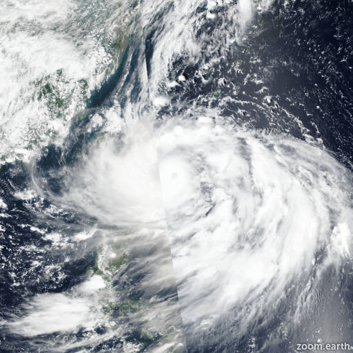
Satellite images, weather maps and tracks of Super Typhoon Hinnamnor 2022, August 27 - September 7. Max wind speed 255km/h.
Hinnamnor (Philippine name Henry) is located 206 km northeast of Busan, South Korea, and has moved northeastward at 57 km/h (31 knots) over the past 6 hours.
Hinnamnor is embedded within a strong midlatitude shortwave trough with weak frontal structure, and has commenced extra-tropical transition. Infrared imagery shows asymmetric convection obscuring the low-level circulation center (LLCC) with the bulk of the deep convection shearing poleward due to strong southerly wind shear.
Microwave imagery shows the system has maintained a defined LLCC with limited curved banding, however, a delta rain region is evident over the northern quadrant.
Based on the defined LLCC, RJTD radar fix and an ASCAT ambiguity image, there is high confidence in the initial position. The initial intensity is assessed at 140 km/h (75 knots) primarily based on a RADARSAT-2 SAR pass showing a swath of 130-145 km/h winds (70-78 knots) over the east and southeast quadrants.
Although not overly impressive, surface observations from Busan around 05/19:00 UTC-21:00 UTC, indicated maximum winds of 65 km/h (35 knots) gusting to 120 km/h (64 knots) and minimum sea-level pressure near 967 hPa, which corresponds to a 75 knot system.
Hinnamnor is forecast to rapidly transition into a strong extra-tropical, cold-core low in 12 hours as it gains frontal characteristics and approaches the midlatitude jet with very high wind shear (40-50 knots).
This is the final warning on this system by JTWC. The system will be closely monitored for signs of regeneration.
Maximum significant wave height is 8.2 meters (27 feet).
Information provided by the Joint Typhoon Warning Center (JTWC).