Tropical Cyclone Guambe 2021
Last Modified:
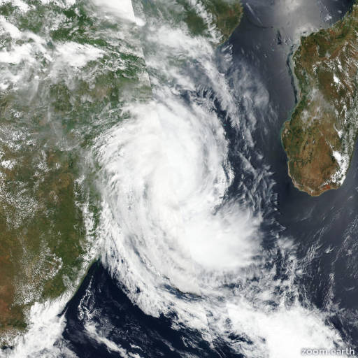
Satellite images, weather maps and tracks of Tropical Cyclone Guambe 2021, February 14 - 22. Max wind speed 165km/h.
Guambe is located 1389 km (750 nautical miles) south-southeast of Europa Island, and has tracked east-southeastward at 65 km/h (35 knots) over the past 6 hours.
The current position is situated within a partially-exposed center feature evident in infrared satellite and SSMIS imagery. The intensity is consistent with time-late ASCAT data from around 21/18:00 UTC, which indicated an intensity around or slightly higher than 100 km/h (55 knots).
Guambe is rapidly accelerating into the westerly flow pattern as it mergers with a mid-latitude trough. Following a rapid transition, Guambe now fully extratropical.
The system will continue to move rapidly east-southeastward as a storm force low with baroclinic support during the 12-hour forecast period.
This is the final warning on this system by JTWC. The system will be closely monitored for signs of regeneration.
Maximum significant wave height is 6.4 meters (21 feet).
Information provided by the Joint Typhoon Warning Center (JTWC).