Measure Distance

Measure Area

Click on the map to add points. Double‑click to finish.

Tap on the map to add points.

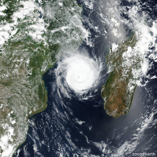
Tropical Storm Gezani 2026

Last Modified:

Tropical Storm Gezani

Live tracking map, satellite, radar, and forecasts of Tropical Storm Gezani 2026 over Madagascar. Current wind speed 130km/h. Max 205km/h.

Gezani is located 115 km northeast of Antananarivo, Madagascar, and has tracked westward at 17 km/h (9 knots) over the past 6 hours.

Gezani is forecasted to track west-southwestward through central Madagascar over the next 18 hours along the northwest extent of the subtropical ridge centered to the southeast.

As the system re-emerges over open water, the cyclone will continue southwestward toward the subtropical ridge axis in around 3 days. Following the next 3 days, Gezani will begin rounding the western edge of the subtropical ridge axis as the track becomes generally southward for 24 hours until the next 92 hours.

Gezani is then forecasted to enter a period of competing steering mechanisms, with an upper-level cut-off low just east of Madagascar adding a southerly channel of gradient winds through the mid-levels, driving the cyclone eastward into the next 5 days as the associated height gradient tightens against a deep-layer subtropical ridge centered to the west over southern Africa.

Regarding intensity, Gezani is forecasted to continue rapidly weakening over the next 12 to 18 hours due to persistent frictional influences as the cyclone tracks through central Madagascar.

As the cyclone re-emerges over open water in 12 to 18 hours, Gezani is forecasted to begin gradually intensifying through a favorable environment, with low wind shear, warm sea surface temperatures, and supportive outflow aloft.

As the cyclone begins rounding the subtropical ridge axis, continued intensification to 150 km/h (80 knots) is forecasted with enhanced upper-level dual-channel outflow. Following the next 3 days, wind shear is forecasted to begin increasing to more than 30 km/h (15 knots) as sea surface temperatures begin to cool, initiating a slight weakening trend to 120 km/h (65 knots) in 4 to 5 days.

Model guidance and artificial intelligence (AI) guidance remain in very tight agreement through the initial 3 days of the forecast period, with a cross-track spread of just 143 km. Following the next 3 days, numerical model and AI solutions begin to diverge, indicating a potential bifurcation trend due to uncertainties in the competing steering mechanisms in 3 to 5 days.

The cross-track spread increases significantly in 4 to 5 days, with the bulk of guidance showing an eastward track until the end of the forecast period.

A few outliers remain, with NAVGEM indicating a westward track into Mozambique after 4 days and the UKMET deterministic solution showing poleward progression after 3 days.

The JTWC track forecast has been placed with high confidence and near the JTWC multi-model consensus until the next 3 days, and low confidence thereafter due to uncertainties in the aforementioned steering flow.

Regarding intensity, the JTWC intensity forecast has been assessed with medium confidence throughout the forecast period as the bulk of the JTWC multi-model consensus guidance characterizes gradual intensification as the system re-emerges over water, with a steady weakening trend in 3 to 5 days.