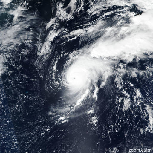
Tropical Storm Gabrielle 2025
Last Modified:

Live tracking map, satellite images and forecasts of Tropical Storm Gabrielle 2025 in the central Atlantic Ocean. Current wind speed 50mph. Max 85mph.
The overall structure of Gabrielle hasn't changed too much. The cloud pattern of the cyclone consists of a large comma shape. GOES-19 CIRA proxy-vis imagery and a recent 17/23:42 UTC ASCAT-B overpass clearly indicate that the surface wind center is at the bottom of the upper portion of the comma head. The strongest ASCAT wind vectors are the same magnitudes as the pass from 12 hours prior, so the intensity is held at 50 mph (45 knots) for this advisory.
Gabrielle still has a very large and broad envelope of convection and winds. It is quite atypical to see a structure like this for a tropical cyclone in this part of the world. Strong westerly shear should continue on Thursday, then gradually abate at some point on Friday. The other factor that is detrimentally impacting Gabrielle is the very dry air seen on water vapor imagery in the open area of the comma, to the south and west of the center. Even after the shear abates, Gabrielle will continue moving through an environment of dry air through Friday, with moistening along its path over the weekend. The official intensity forecast has been decreased during the 24–48 hours period, in agreement with most of the reliable intensity guidance. The new NHC intensity forecast is near the middle of the guidance envelope through 48 hours, then near the high end of the guidance thereafter, and still calls for Gabrielle to be a hurricane at days 4–5.
Track forecast confidence remains relatively low. This system should pass well east and north of the Leeward Islands, but interests in Bermuda should monitor forecasts during the next several days.