Measure Distance

Measure Area

Click on the map to add points. Double‑click to finish.

Tap on the map to add points.

Tropical Storm Fernand 2025

Last Modified:
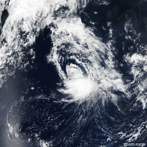
Tropical Storm Fernand

Live tracking map, satellite images and forecasts of Tropical Storm Fernand 2025 near Bermuda. Current wind speed 50mph. Max 60mph.

Fernand continues to produce bursts of convection near the low-level center, with cold cloud tops notes in satellite images. Microwave imagery shows an improving structure with curved banding and a small inner core trying to become established. Subjective and objective satellite intensity estimates range between 40 to 60 mph (50 knots). Using a blend of these estimates, the initial intensity is raised to 50 mph (45 knots).

The initial motion remains north-northeast at an estimated motion of 025/11 knots. The system is being steered around the western periphery of a subtropical ridge. This north-northeast to northeast motion is anticipated throughout the forecast period as the system is steered around the ridge and into the mid-latitude southwesterlies, with an increase is forward speed. The latest NHC forecast is similar to the previous, and lies between the HCCA corrected consensus and Google DeepMind aids.

Fernand is forecast to gradually strengthen during the 12–24 hours, as the system remains over warm water and light wind shear. However, there is some drier mid-level air depicted via satellite and latest SHIPS guidance, which may hinder convective organization at times. By late Monday or Tuesday, vertical wind shear begins to increase and sea surface temperatures decrease significantly along the forecast track. This will cause the system to weaken, and become post-tropical on Wednesday. The NHC intensity forecast is similar to the previous one, and remains near the consensus aids.