Tropical Cyclone Faraji 2021
Last Modified:
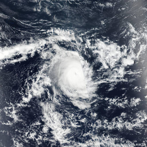
Satellite images, weather maps and tracks of Very Intense Tropical Cyclone Faraji 2021, February 4 - 16. Max wind speed 255km/h.
Faraji is located 1861 km (1005 nautical miles) east of Port Louis, Mauritius, and has tracked west-southwestward at 15 km/h (8 knots) over the past 6 hours.
Satellite imagery shows a fully exposed low level circulation center with isolated weak convection displaced well to the southeast due to the strong northwesterly flow aloft.
The initial position is placed with high confidence based on the exposed circulation in animated visible imagery. The initial intensity is lowered to 55 km/h (30 knots) with high confidence based on a Metop-A scatterometer pass which indicated an isolated patch of 55 km/h winds (30 knots) in the southeast quadrant and less than 35 km/h (20 knots) in the other three quadrants.
Having dissipated below warning criteria due to the combined effects of dry air entrainment, northwesterly convergent flow aloft, and persistent moderate (15-20 knots) wind shear, the remnants of Faraji will continue tracking generally westward along the northern periphery of the low to mid-level subtropical ridge located to the south but are not expected to redevelop.
This is the final warning on this system by JTWC. The system will be closely monitored for signs of regeneration.
Maximum significant wave height is 4.9 meters (16 feet).
Information provided by the Joint Typhoon Warning Center (JTWC).