Measure Distance

Measure Area

Click on the map to add points. Double‑click to finish.

Tap on the map to add points.

Tropical Storm Etau 2026

Last Modified:
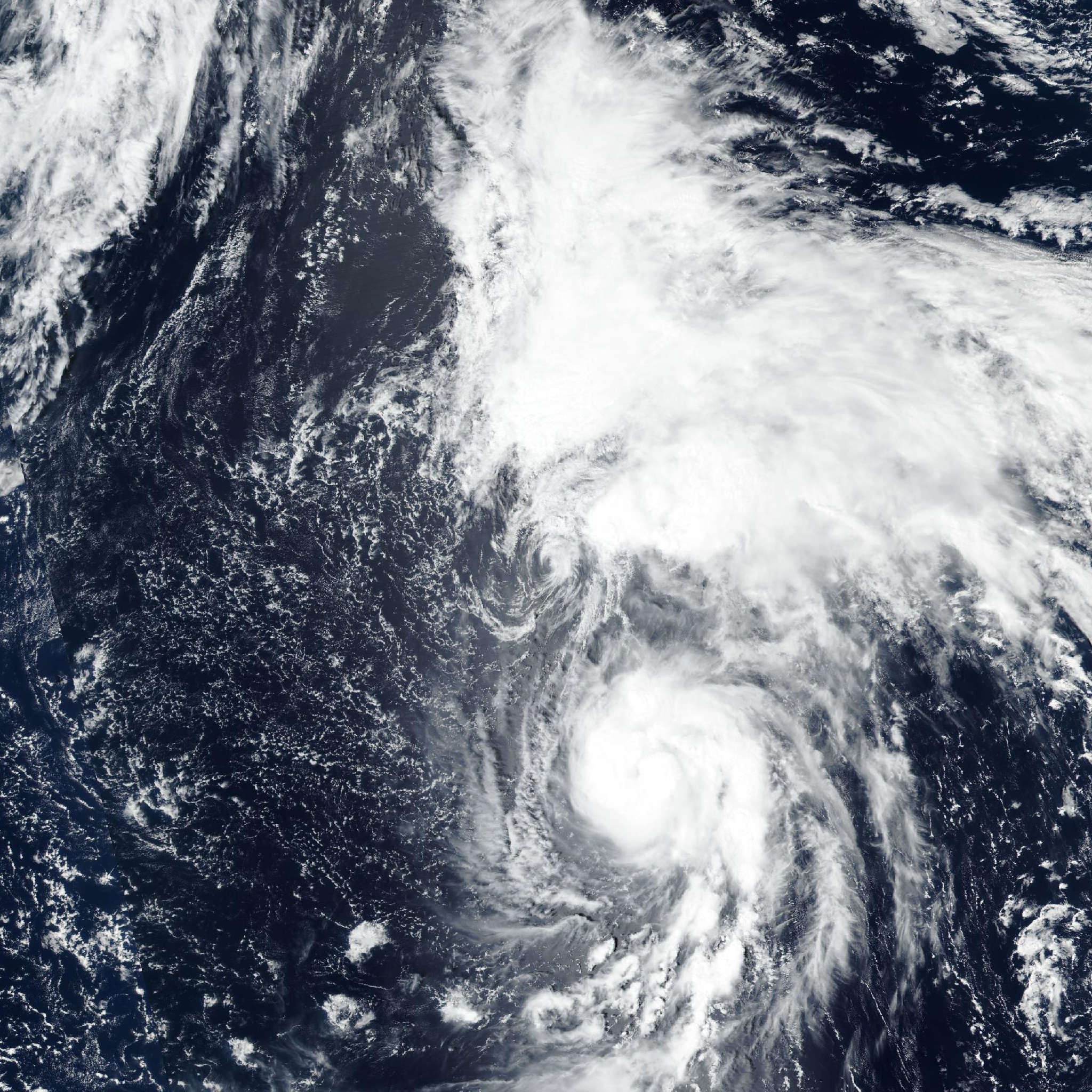
Tropical Storm Etau

Live tracking map, satellite, radar, and forecasts of Tropical Storm Etau 2026 (台風22号) in the western Pacific Ocean. Current wind speed 85km/h.

Etau (Japanese Typhoon Number 22) is located 539 km north of Wake Island, and has tracked north-northwestward at 20 km/h (11 knots) over the past 6 hours. Maximum significant wave height is 6.1 meters (20 feet).

Etau is tracking northward along the western flank of a deep-layer subtropical ridge and is forecast to continue this general motion for the next 36 hours.

After 36 hours, the system begins to decelerate as it moves into a weaker steering environment as the ridge to the northeast is weakened due to the passage of the remnants of Lala.

In 2 days, the system will have become quasistationary as it moves deeper into the weak and competing steering pattern and moves under an upper-level low.

The system remains quasistationary, or looping over the next 3 days as it undergoes binary interaction and Fujiwhara motion with 20W moving up rapidly from the south.

As 20W reaches a position north of Etau in 3 days, Etau will move off slowly to the northeast as the two systems slowly extricate themselves from one another.

Regarding intensity, the persistent negative influence of moderate westerly shear will continue to inhibit significant intensification. A slight increase in intensity is possible in the next 12 hours, but will be temporally limited.

The forecast calls for the system to maintain its current intensity over the next 36 hours before gradually weakening through the remainder of the forecast as it moves into cooler waters, faces persistent shear and becomes enveloped in dry air.

Subtropical transition (STT) begins at 3 days, and will be completed in 5 days, but possible as early as the next 4 days. Track guidance is in generally good agreement over the next 2 days, with cross-track spread increasing to 389 km by this point.

Consistent with earlier model runs, the AI models are struggling to pick up on the climatologically atypical fujiwhara, and taking the system straight through on a northward then northeastward track over the next 5 days.

The deterministic models on the other hand begin to show erratic track behavior after 60 hours, as the system begins to interact and fujiwhara with 20W moving up from the southeast.

The result is a highly chaotic track spread which extends across nearly 1852 km. The JTWC forecast is based on a blend of the available trackers, but most closely conforms to the modified consensus mean.

Confidence is low throughout the forecast period. Regarding intensity, model guidance is in better agreement, with the consensus and TC-specific intensity guidance depicting an intensity that maxes out at 95 km/h (50 knots) (GFS) but for the most part is confined to 85 km/h (45 knots) or less over the next 36 hours, before gradually weakening over the next 5 days.

The JTWC forecast is closely aligned with the HAFS-A with medium confidence.