Measure Distance

Measure Area

Click on the map to add points. Double‑click to finish.

Tap on the map to add points.

Tropical Storm Elida 2026

Last Modified:
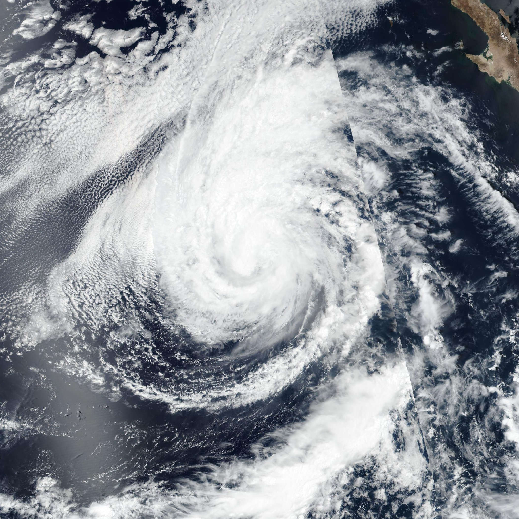
Live tracking map, satellite, radar, and forecasts of Tropical Storm Elida 2026 in the eastern Pacific Ocean. Current wind speed 45mph. Max 90mph.

Elida continues to slowly become better organized on satellite imagery after a nocturnal burst of deep convection. However, earlier data from the new AMSR-3 microwave imager showed that the circulation remains tilted with height, with the low-level center located northwest ahead of the deepest convection. The subjective Dvorak estimate from TAFB remains T3.0/45 knots, and the objective intensity estimates from UW-CIMSS have slightly increased between 39–44 knots. Therefore, the initial intensity has been increased to 45 mph (40 knots) for this advisory.

Based on the earlier microwave imagery, Elida position was adjusted a little north of the previous track, but still appears to be moving westward at 280/13 knots. A prominent subtropical ridge north of Elida should maintain this general motion through the day. Afterwards, this ridge is expected to shift eastward as a weakness develops ahead of Elida, associated with a mid-latitude trough located off the California coast. This synoptic weather pattern should allow Elida to begin gaining more latitude by the end of this week as it gradually turns northwestward. This track should continue through early next week. The track guidance is in fairly good agreement early on, but across-track spread increases notably by the end of the forecast period. The latest NHC track forecast was adjusted a little north over the first 24 hours, due to the initial position adjustment, but converges close to the prior forecast track. This forecast is also very close to the latest Google DeepMind ensemble mean (GDMI).

The tropical storm is currently over a very warm ocean sea-surface (30°C) and embedded in a fairly moist environment. However, Elida's vertical structure is tilted to the south with height, and shear analysis from the GFS and ECMWF show evidence of mid-level northerly shear undercutting the convective outflow. Thus, short-term intensification will likely be on the gradual side. Assuming Elida becomes more vertically aligned and develops an inner core, a faster rate of intensification could occur in 36–48 hours. After 60 hours, the tropical cyclone will cross the 26°C isotherm with weakening expected to begin by this weekend. The latest NHC intensity forecast has a slightly lower peak than the prior cycle, but still remains on the upper end of the intensity aids. This forecast is closest to the latest GDMI and HCCA aids, but is higher than the HAFS-A/B guidance.