Measure Distance

Measure Area

Click on the map to add points. Double‑click to finish.

Tap on the map to add points.

Tropical Storm Dujuan 2026

Last Modified:

Tropical Storm Dujuan

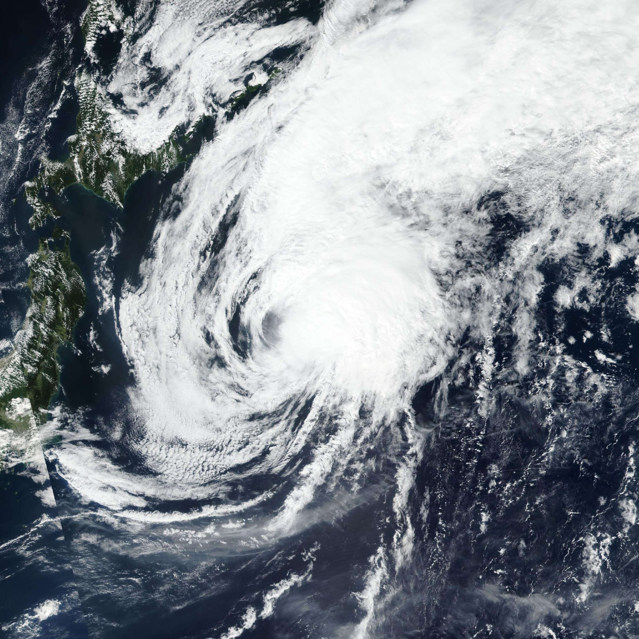
Live tracking map, satellite, radar, and forecasts of Tropical Storm Dujuan 2026 (台風25号) in the western Pacific Ocean. Current wind speed 95km/h. Max 120km/h.

Dujuan (Japanese Typhoon Number 25) is located 982 km east-southeast of Iwo To, and has tracked northward at 54 km/h (29 knots) over the past 6 hours. Maximum significant wave height is 6.4 meters (21 feet).

Dujuan is currently tracking northward and will begin to curve to the northwest within the next few hours.

Dujuan will move northwestward over the next 2 days while the southward extension of the steering ridge retreats. As Dujuan approaches the ridge axis, speed of advance will slow particularly in 1 to 2 days.

Dujuan will round the ridge axis in around 60 hours and begin accelerating to the northeast for the remainder of the forecast period. In around 4 days, Dujuan is expected to cross the 26°C isotherm and encounter an increasingly hostile environment characterized by high (30–40 knots) wind shear, dry air, and jet interaction inducing weak thermal advection.

Regarding intensity, Dujuan is expected to very gradually intensify through its peak at 60 hours. The environment is expected to remain relatively consistent over the next 60 hours, though the slightly elevated wind shear may prohibit significant intensification or even stagnate intensification entirely.

Wind shear is currently not expected to have a major impact on intensity, and Dujuan is still forecast to reach typhoon strength. The main inhibitor to significant intensification remains the storm’s asymmetric core.

In around 2 to 60 days, wind shear is expected to abate slightly and divergence aloft is expected to increase, contributing to the intensification period as Dujuan approaches the ridge axis.

Dujuan will remain at tropical-storm strength while it undergoes and completes extratropical transition. Dujuan is forecast to begin extratropical transition between the next 4 days and complete transition after 5 days.

Deterministic model track guidance remains in strong agreement through the entirety of the forecast period, supporting the JTWC track forecast with high confidence.

Reliable deterministic intensity guidance is also in good agreement in a relatively stable intensity over the next 5 days. However, several JTWC rapid intensification aids have triggered, indicating a possibility for rapid intensification in the next 24 to 40 hours.

JTWC has determined Dujuan has a low chance of rapid intensification, and the intensity forecast is in close alignment with the multi-model consensus and the following global and mesoscale models: GFS, COAMPS, HAFS, and HWRF. As a result of the uncertainty, the JTWC intensity forecast is assessed with overall medium confidence.