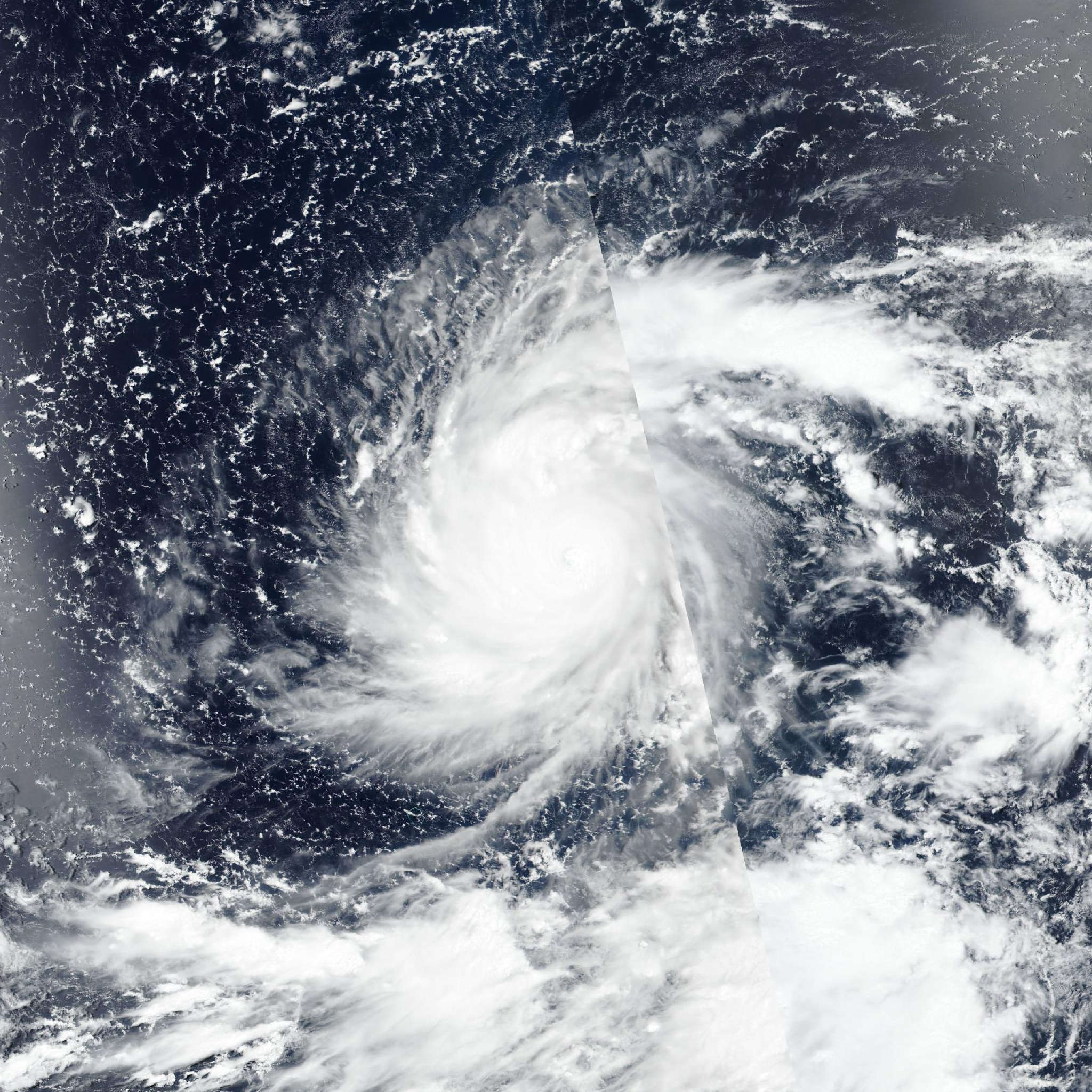
Typhoon Dolphin 2026
Last Modified:
Live tracking map, satellite, radar, and forecasts of Typhoon Dolphin 2026 (台風13号) in the western Pacific Ocean. Current wind speed 230km/h. Max 285km/h.
Dolphin is located 715 km south-southeast of Wake Island, and has tracked west-northwestward at 15 km/h (8 knots) over the past 6 hours. Maximum significant wave height is 12.5 meters (41 feet).
Dolphin has turned towards the northwest with an average forward speed of 15 km/h (7–9 knots), a motion that will persist over the next 4 days under the steering influence of a ridge complex over the central North Pacific.
For the first 4 days, the system will move toward a weakness in the subtropical ridge created by a longwave trough located east of Honshu. Towards the end of the forecast period, the trough will weaken, allowing the subtropical ridge to rebuild north of Dolphin and induce a slightly more westward motion.
The system appears to have reached an initial peak intensity near super typhoon status between 28/15:00 UTC and 28/18:00 UTC. The intensity forecast anticipates some initial weakening over the next 12 hours as a result of the ongoing eyewall replacement cycle.
The forward motion has also slowed to 10 km/h (6 knots) in the past 3 hours. If it does not regain forward speed soon, then the risk of upwelling of cooler ocean waters will increase, further hindering development.
Once the eyewall replacement cycle completes, however, Dolphin will undergo another round of significant intensification. The system will traverse over exceptionally warm sea surface temperatures of 31–32°C within a low-shear environment.
The forecast shows steady to rapid intensification to a second, higher peak of 285 km/h (155 knots) at 2 days. This and any subsequent eyewall replacement cycle events lead to less predictable fluctuations in intensity and expansion of the wind field.
The guidance envelope is rather tight over the next 4 days, with a cross-track spread of 204 km once NAVGEM is excluded as a poleward outlier.
The spread increases to nearly 370 km at 5 days, driven by a divergence in the eventual westward turn. The GEFS and UKMET ensemble means favor a longer continuation of the northwestward trajectory, while the ECMWF and GFS models project an earlier westward turn.
The JTWC forecast track, which is virtually unchanged over the next 60 hours, is positioned near the multi-model consensus up to 60 hours and then hedges towards the more westward solutions.
The reliable intensity aids continue to show intensification. HAFS-A remains the strongest solution with a peak of 315 km/h (170 knots). The JTWC intensity forecast temporarily deviates from this immediate upward trend to account for the eyewall replacement cycle.
After 24 hours, the forecast shows the system rebounding sharply to 285 km/h (155 knots), which is between the HAFS-A and COAMPS-TC output and is closest to the experimental Google DeepMind model.
The intensity aids show slight weakening in the extended forecast period, likely due to a combination of additional eyewall replacement cycle events, the structural effects of wind field expansion, and decreasing ocean heat content.