Tropical Storm Danilo 2021

Last Modified:
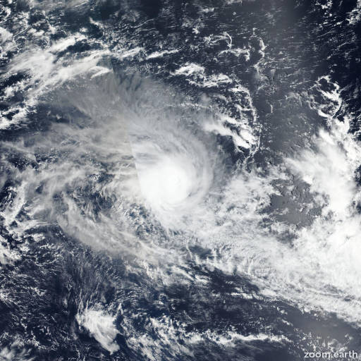
Satellite images, weather maps and tracks of Severe Tropical Storm Danilo 2021, December 30 - January 12. Max wind speed 130km/h.

Danilo is located 748 km (404 nautical miles) east-northeast of Port Louis, Mauritius, and has tracked westward at 24 km/h (13 knots) over the past 6 hours.

Infrared satellite imagery shows increasingly disorganized flaring convection around an ill-defined low level circulation center (LLCC). A SSMIS pass reveals the chaotic nature of the low level convergent flow, with only two discrete convective towers amid otherwise shallow convection.

The initial position is placed with low confidence based on the PGTW fix and aforementioned SSMIS. Environmental analysis indicates that wind shear is generally low (5-10 knots), however, weak upper level winds are providing poor outflow support and sea surface temperatures are decreasing to between 26-27°C.

The 850 mb vorticity signature has also weakened and become more asymmetric. Danilo is forecast to dissipate as it tracks west-southwestward along the western periphery of a low to mid-layer subtropical ridge.

Numerical model guidance remains in fair agreement with 32 nautical miles spread in 12 hours as this system dissipates over water. Intensity guidance is generally flat, with the 10-member COAMPS-TC ensemble indicating an 80 to 90% probability of a steady or weakening trend.

The JTWC forecast track remains consistent with the previous forecast and favors the ECMWF model solution with moderate confidence. This is the final warning on this system by JTWC.

The system will be closely monitored for signs of regeneration.

Maximum significant wave height at 09/00:00 UTC is 11 feet (3.4 meters).

Information provided by the Joint Typhoon Warning Center (JTWC).