Measure Distance

Measure Area

Click on the map to add points. Double‑click to finish.

Tap on the map to add points.

Tropical Depression Co-may (Emong) 2025

Last Modified:

Tropical Depression Co-may (Emong)

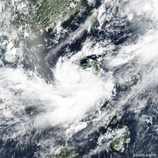
Live tracking map, satellite images and forecasts of Tropical Depression Co-may 2025 (台風8号) near the Japanese Miyako Islands. Current wind speed 55km/h. Max 130km/h.

Co-may is located 435 km southwest of Kadena Air Base, and has tracked northeastward at 39 km/h (21 knots) over the past 6 hours. Maximum significant wave height is 5.2 meters (17 feet).

Co-may is embedded within an extensive swath of southerly flow that runs from the east Philippine Sea northward along the eastward edge of the system, then northward over the Ryukyu Islands. This enhanced flow pattern between the system and the low-level steering ridge will push Co-may poleward through the forecast period.

The system will steadily open up and weaken under marginal conditions to include dry air and low to moderate wind shear. Additionally, the upper-level circulation is decoupled from the low-level circulation, which is embedded within low- to mid-level southerly flow.

After 24 hours, the system is expected to dissipate. However, the global models show a broad trough developing across the Okinawa region, with a belt of 45–55 km/h winds (25–30 knots) over the northern edge, and possible development of a new, weak surface low near Okinawa in one to two days. Deterministic model guidance is in good agreement through the forecast period, with a 93 km cross-track spread at 24 hours.

Reliable intensity guidance is in poor agreement after 24 hours likely due to the formation of another low pressure area near Okinawa.