Measure Distance

Measure Area

Click on the map to add points. Double‑click to finish.

Tap on the map to add points.

Tropical Storm Chan-hom 2026

Last Modified:
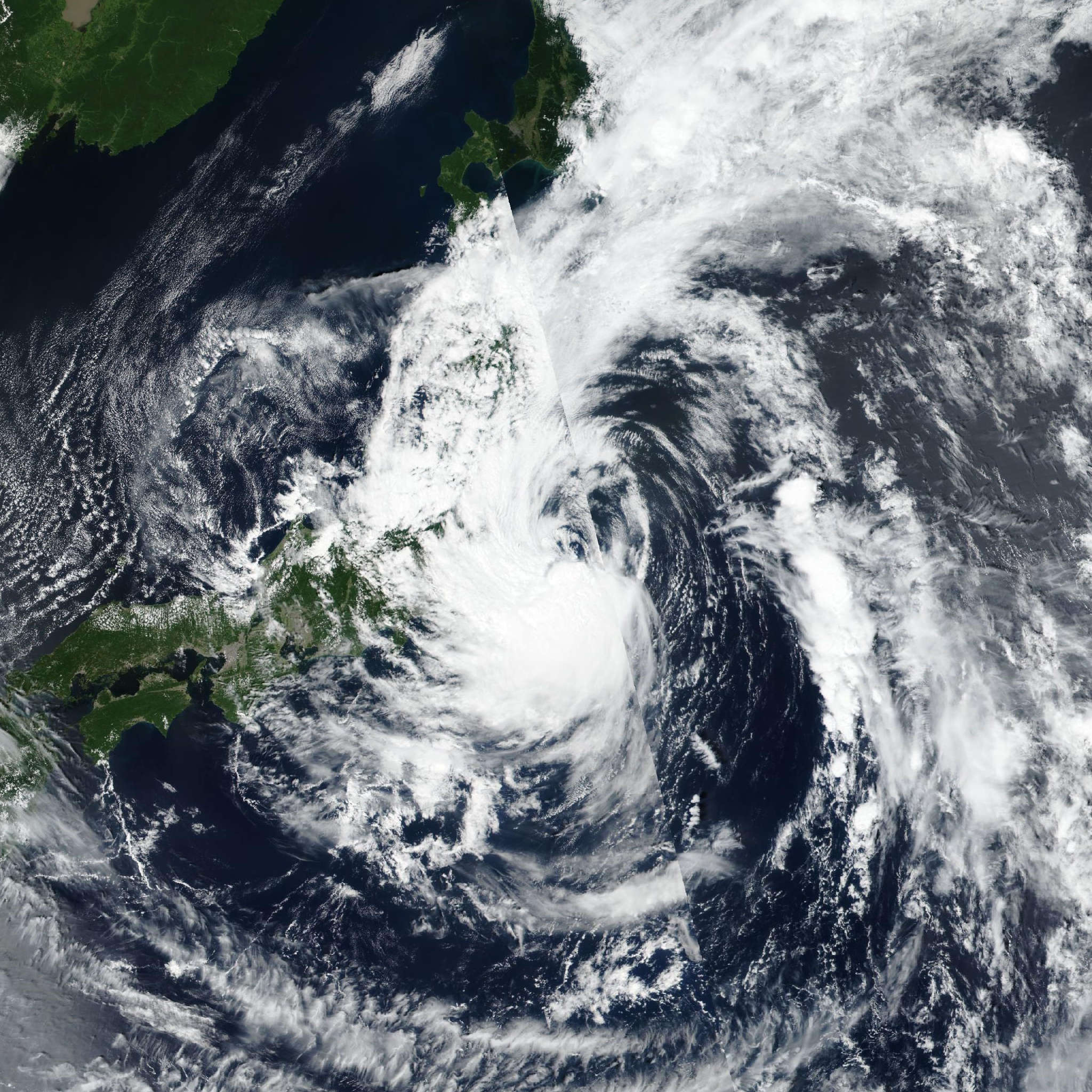
Tropical Storm Chan-hom

Live tracking map, satellite, radar, and forecasts of Tropical Storm Chan-hom 2026 (台風15号) in the western Pacific Ocean. Current wind speed 65km/h. Max 95km/h.

Chan-hom is located 1469 km east-southeast of Misawa, Japan, and has tracked west-northwestward at 28 km/h (15 knots) over the past 6 hours. Maximum significant wave height is 4.9 meters (16 feet).

Chan-hom will continue to track westward along the southern flank of a low- to mid-level subtropical ridge for the next 12 to 24 hours.

The system will begin to decelerate after 12 hours, as the ridge begins to erode from the west due to an approaching upper-level trough moving east from Japan.

After 24 hours, the system slows down to 10 km/h (5–6 knots) while turning northwestward as a weakness develops in the ridge over Hokkaido, with the ridge reorienting along a northwest-to-southeast axis.

In 3 days, the trough and associated weakness in the ridge move east and are replaced by a new ridge developing over far eastern Russia, which will drive Chan-hom onto a westward track across the northern portion of Honshu. Landfall along the coast of Honshu, in the general vicinity of Sendai, Japan, is expected in around 3 days. Thereafter, the system rapidly moves into the Sea of Japan along the strong gradient on the southern side of the building ridge over eastern Russia.

As the system weakens and shallows out in the extended forecast, the steering gradient weakens, allowing the system to decelerate over the next 5 days.

Regarding intensity, Chan-hom will face marginal to marginally unfavorable conditions for the next 12 to 24 hours, as it moves northwestward generally in alignment with the upper-level low.

In around 24 hours, the upper low opens up into a trough and begins to decouple from Chan-hom, allowing for modest improvement in the overall environment.

In 2 days, another upper-level low develops near Sendai, with a trough extending southeastward to the south of Chan-hom, opening up a robust, near-jet-level poleward outflow channel.

Chan-hom will tap into this outflow channel and intensify to a peak of 95 km/h (50 knots) in 60 hours. Further evolution of the upper-level pattern places Chan-hom on the northwestern (convergent) side of the upper low in 3 days, and the system will weaken slightly as it approaches landfall.

The system will begin a rapid subtropical transition (STT) as it crosses Honshu and moves into the Sea of Japan, completing STT in 5 days. The system will steadily weaken as it undergoes STT.

Track guidance is in overall good agreement on the track scenario. All guidance points to a westward track over the next 24 hours, followed by a northwestward trajectory through landfall at 3 days.

Cross-track spread gradually increases to 463 km at 3 days, with GALWEM positioned on the northern edge of the envelope and the ECMWF on the southern flank.

The ECMWF is a significant southern outlier, tracking the system over the vicinity of iwaki, displaced nearly 185 km from the primary model cluster.

Ensemble guidance shows a fairly significant amount of uncertainty over the next 3 days, with member dispersion extending from Hokkaido in the north to south of Tokyo in the south.

The JTWC forecast is placed near the experimental AI consensus mean with medium confidence, decreased due to the large ensemble member dispersion.

In the extended range, both the consensus package and the super ensemble show increased spread and dispersion, lending low confidence to the JTWC forecast track, which is positioned near the AI consensus mean.

Intensity guidance is in good agreement overall. However, the JTWC forecast is placed lower than all the guidance save for Google DeepMind over the next 36 hours, before joining the consensus envelope (which peaks at 95 km/h (50 knots) at 60 hours) through the remainder of the forecast.