Typhoon Chan-hom 2020
Last Modified:
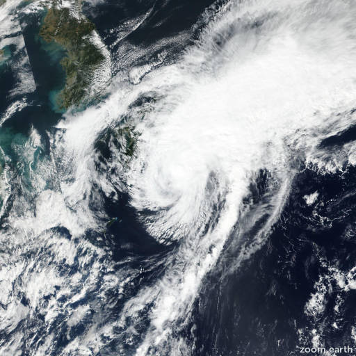
Satellite images, weather maps and tracks of Typhoon Chan-hom 2020, October 3 - 13. Max wind speed 150km/h.
Tropical Depression Chan-Hom, located approximately 138 nautical miles north of Chichi Jima, has tracked southward at 8 knots over the past six hours.
Animated multispectral satellite imagery depicts a fully-exposed system with low-level cloud lines wrapping into a defined center, which supports the initial position with good confidence.
A 12/06:48 UTC SSMIS 91GHz image reveals shallow banding wrapping into a defined low-level circulation center with no deep convection.
The initial intensity is assessed at 25 knots based on recent ASCAT data.
Environmental analysis indicates unfavorable conditions with moderate (20-25 knots) vertical wind shear, convergence aloft and significant dry air entrainment.
TD 16W is forecast to track southeastward along the northeast periphery of the low-level subtropical ridge and is forecast to dissipate by hour 12.
This is the final warning on this system by JTWC.
The system will be closely monitored for signs of regeneration.
Maximum significant wave height at 12/06:00 UTC is 10 feet (3 meters).
Information provided by JTWC.