Tropical Storm Champi 2026
Last Modified:
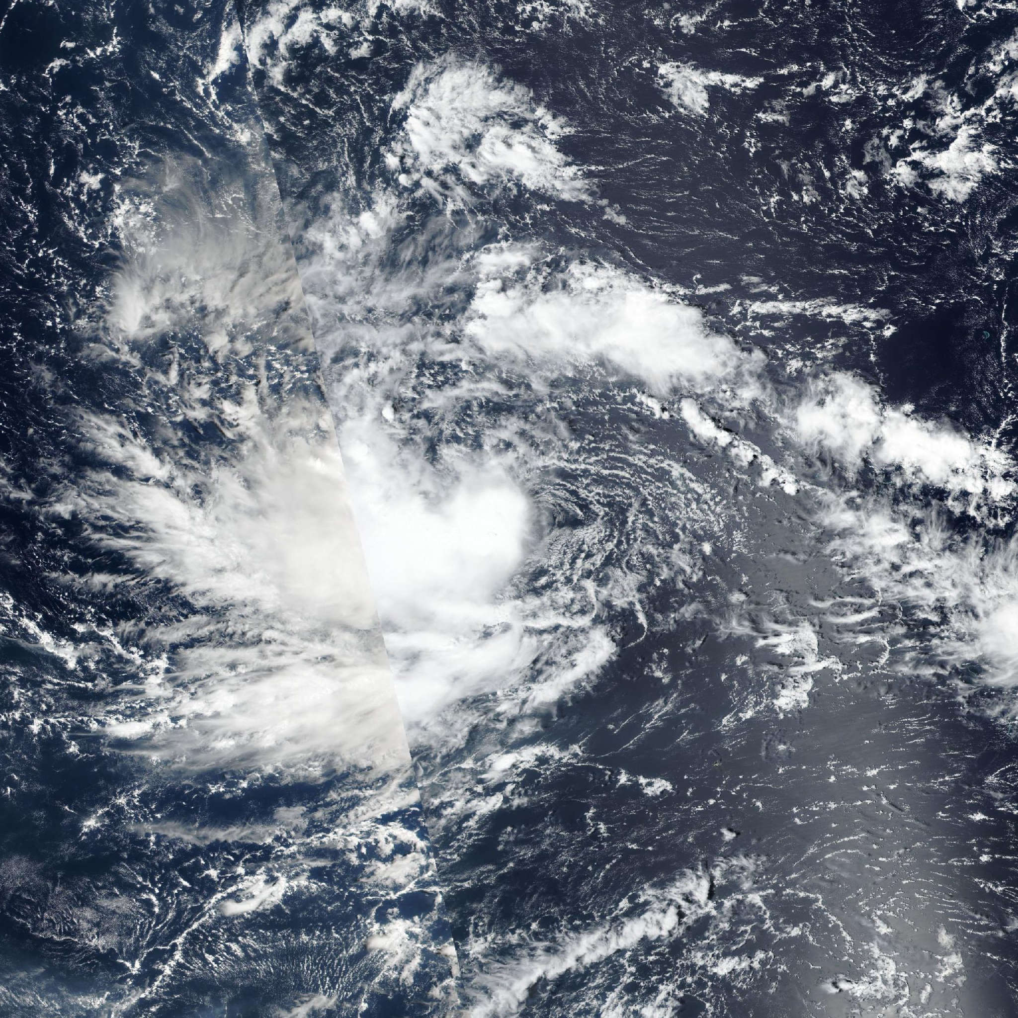
Live tracking map, satellite, radar, and forecasts of Tropical Storm Champi 2026 (台風30号) in the western Pacific Ocean. Current wind speed 75km/h. Max 240km/h.
Champi (Japanese Typhoon Number 30) is located 1282 km east of Andersen Air Force Base, and has tracked west-northwestward at 19 km/h (10 knots) over the past 6 hours. Maximum significant wave height is 4.6 meters (15 feet).
Champi is forecast to continue steadily tracking west-northwestward over the next 36 hours while it remains on the southern edge of the steering subtropical ridge centered far to the north.
At around 36 hours, a deep-layer trough is expected to pass to the north, weakening the ridge and forcing it to retreat eastward. Simultaneously, a second subtropical ridge is expected to build immediately following the passage of the trough and assuming steering influence over Champi in 36 hours to 5 days.
It is expected to be a smooth transition from one subtropical ridge to the other, and the new steering environment will maintain the steady west-northwestward track for the remainder of the forecast period.
Regarding intensity, Champi is forecast to steadily intensify over the next 12 hours while the system continues to consolidate and organize. Following the next 24 hours, Champi is forecast to undergo a prolonged period of rapid intensification (RI) in response to the increasingly favorable environment it will encounter in 24 hours to 3 days.
Though wind shear is expected to remain approximately 30 km/h (15 knots) over the next 4 days, the equatorward and westward outflow channels are expected to strengthen and Champi is expected to track through a region of slightly higher (100–125 kJ per cm squared) ocean heat content.
After 3 days, Champi will continue to intensify gradually until peaking at 4 days. After that point, Champi will likely maintain a high intensity, as environmental conditions will continue to improve.
Namely, wind shear is expected to drop to less than 20 km/h (10 knots) in 4 days and ocean heat content is expected to increase to above 150 kJ per cm squared. This environment should have no issue sustaining a strong typhoon, however, the potential for an eyewall replacement cycle increases, which would cause a momentary drop in intensity. As a result, the intensity in 4 to 5 days remains relative stable.
The potential of a peak intensity greater than 240 km/h (130 knots) is also within the realm of possibility, depending on how quickly Champi is able to consolidate over the next 24 hours, thereby impacting when the system is able to commence rapidly intensifying.
Deterministic model track guidance is in strong agreement throughout the forecast period, but particularly through the first 2 days. The cross-track spread as the storm passes through the Northern Marianas is 85 nautical miles, even including two outliers (GFS and GEFS).
Discounting those, the cross-track spread drops to 102 km at closest point of approach, with the bulk of guidance supporting a track that clips the northern coast of Guam or passes just offshore.
The excellent model agreement for the first 3 days supports the JTWC near-term track forecast with high confidence. After 3 days, the guidance spreads a minimal amount, compounding to a 370 km cross-track spread at 5 days (excluding GFS and GEFS), lending high confidence to the late-term JTWC track forecast.
The JTWC track forecast is placed in close agreement with the multi-model consensus, experimental AI consensus, and Google DeepMind with overall high confidence.
Reliable intensity aids are in good agreement over the next 36 hours, though there is some disagreement regarding the timing of RI. Several JTWC RI indicators have reached trip criteria, supporting the possibility of RI occurring within the next 1 to 2 days. However, the HAFS-A and HWRF solutions show RI beginning as late as the next 60 hours.
Model guidance also disagrees on the peak intensity and the timing of the peak. The peak intensity spread ranges from 195 km/h (105 knots) and 250 km/h (135 knots), with the timing spread in 3 to 5 days.
The JTWC intensity forecast is in close agreement with the RI aids and the bulk of models over the next 24 hours, then hedged close to the mesoscale models and Google DeepMind over the next 24 hours through the end of the forecast period.
The JTWC intensity forecast is assessed with overall medium confidence.