Measure Distance

Measure Area

Click on the map to add points. Double‑click to finish.

Tap on the map to add points.

Typhoon Bang-lang 2026

Last Modified:
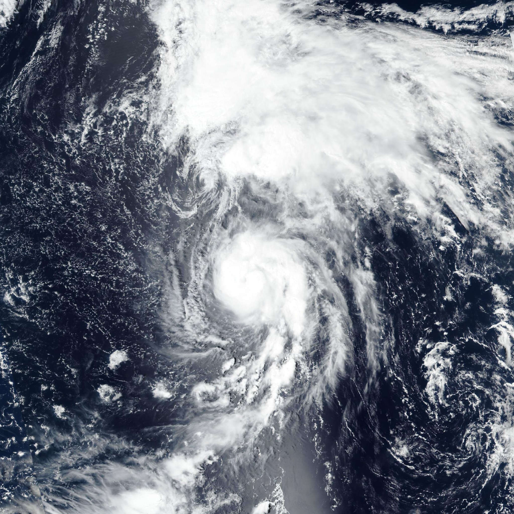
Typhoon Bang-lang

Live tracking map, satellite, radar, and forecasts of Typhoon Bang-lang 2026 (台風23号) in the western Pacific Ocean. Current wind speed 120km/h. Max 140km/h.

Bang-lang is located 346 km north-northeast of Wake Island, and has tracked north-northeastward at 35 km/h (19 knots) over the past 6 hours. Maximum significant wave height is 7 meters (23 feet).

Bang-lang is forecast to continue tracking north-northeastward while it remains under the steering influence of the subtropical ridge centered to its northeast for the next 12 to 24 hours.

In around 12 hours, an upper-level trough is expected to pass to the north and weaken the ridge, inducing a north-northwestward track motion for Bang-lang over the next 2 days. Additionally, Bang-lang has begun interacting with tropical storm Etau, with interaction getting stronger as the two storms are pulled closer together. This interaction will reinforce the north-northwest track motion and cause a curve back to the north after 2 days.

Interaction with Etau may result in storm motion not reflected in the official forecast, as the degree of interaction is still uncertain. Bang-lang is expected to begin subtropical transition (STT) in around 2 days and complete transition in 60 hours.

In 60 hours, Bang-lang is forecast to have crossed the 26°C isotherm and be fully embedded under the upper-level trough. Regarding intensity, Bang-lang is forecast to intensify between 12 and 24 hours as the environment remains marginally favorable.

Starting in around 12 to 24 hours, shear is expected to increase as the upper-level trough passes, inducing additional dry air entrainment. Concurrently, ocean heat content will rapidly drop as the system progresses poleward. As a result, Bang-lang is forecast to gradually weaken in 24 hours to 3 days.

The highly compact nature of the system may cause the intensity to be volatile as small changes in the environment could have a large impact on the vortex.

Deterministic model track guidance is in good agreement over the next 36 hours. After 36 hours, guidance diverges quite a bit as the binary interaction between Bang-lang and Etau becomes more pronounced and model guidance struggles to initialize it. As a result, the JTWC track forecast is placed with low confidence.

Intensity guidance remains in poor—though improving—agreement with a few rapid intensification (RI) aids still triggering. Peak intensities range from 120–150 km/h (65–80 knots) (HAFS-A, HWRF, COAMPS-TC, GFS, and experimental Google DeepMind) to 185 km/h (100 knots) (the most aggressive RI aids), creating a significant spread in intensity guidance. However, most aids agree on a peak in about 12 hours.

The JTWC intensity forecast continues to hedge closer to the HAFS-A, HWRF, and COAMPS-TC solutions with very low confidence.