Cyclonic Storm Arnab 2026
Last Modified:
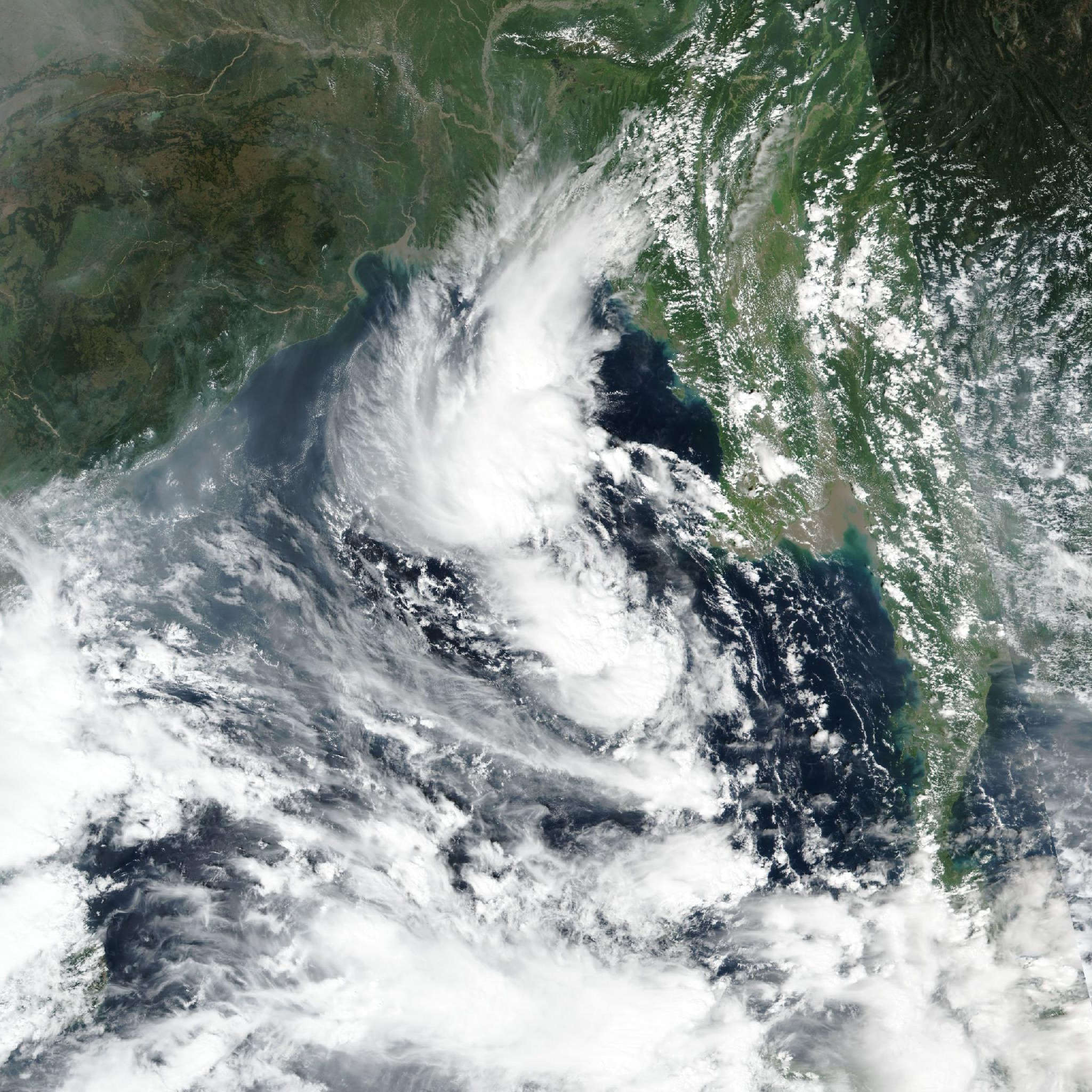
Live tracking map, satellite, radar, and forecasts of Cyclonic Storm Arnab 2026 in the Bay of Bengal. Current wind speed 120km/h. Max 205km/h.
Arnab is located 811 km south of Kolkata, India, and has tracked westward at 7 km/h (4 knots) over the past 6 hours. Maximum significant wave height is 6.4 meters (21 feet).
Arnab is tracking westward along the southern edge of a deep-layer subtropical ridge that is building westward.
Over the next 24 hours, the ridge will maintain a generally westward motion. In 1 to 2 days, interaction with a tropical disturbance near Sri Lanka may introduce a brief west-southwestward component to the track; however, westward motion should remain dominant. Thereafter, Arnab will turn poleward as it reaches the western edge of the subtropical ridge.
The timing of this turn remains a key source of track uncertainty. Conditions will remain highly favorable for intensification over the next 24 hours, with sea surface temperatures near 29 30°C and low wind shear.
Given the ongoing rapid intensification, additional intensification is expected over the next 24 hours, although the rate of intensification remains uncertain.
After 24 hours, a decrease in forward speed may increase the potential for upwelling. In addition, wind shear is forecast to increase to 35–55 km/h (20–30 knots), and land interaction will increase as the system approaches and moves inland. These factors are expected to lead to steady to rapid weakening after 24 hours.
Dissipation over land will occur in 3 days. Track guidance is in good agreement through the forecast period. GFS and the GEFS ensemble mean diverge slightly from the core guidance group in 12 to 36 hours, depicting a more west-southwestward track due to stronger interaction with the tropical disturbance to the south.
The JTWC forecast track is placed near the center of the tight core guidance cluster, including ECMWF, Google DeepMind, the multi-model consensus, and the AI-model mean.
The core guidance group remains tightly clustered over the next 3 days, although uncertainty in the disturbance interaction and the timing of the poleward turn supports medium track confidence.
Intensity guidance exhibits a large spread. HAFS-A forecasts a peak of 140 km/h (75 knots), while COAMPS-TC forecasts 165 km/h (90 knots) and Google DeepMind forecasts a peak near 215 km/h (115 knots).
Given the recent rapid intensification trend, the JTWC intensity forecast is placed near the upper end of the guidance envelope, but below the Google DeepMind solution.
Most available intensity guidance supports weakening as shear increases and land interaction commences after 24 hours, and the JTWC forecast follows that overall trend.