Tropical Cyclone Ana 2021
Last Modified:
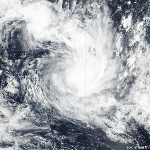
Satellite images, weather maps and tracks of Category 2 Tropical Cyclone Ana 2021, January 28 - February 3. Max wind speed 120km/h.
Satellite images indicate that the low pressure system that is located a couple of hundred miles northeast of Bermuda has become better organized overnight. The low now has a well-defined center of circulation, some central deep convection, and thunderstorms that are organized in curved bands to the north and northeast of the center. The system is considered a subtropical cyclone rather than a tropical cyclone since it is still entangled with an upper-level low as evident in water vapor satellite images, but it does have some tropical characteristics as well. The initial intensity is estimated to be 40 knots, which makes the system Subtropical Storm Ana.
Ana is moving slowly to the west-southwest with the initial motion estimated to be 240/3 knots. An even slower motion is expected later this morning (May 22), and Ana is forecast to meander through tonight while it remains embedded within the upper-level low in weak steering currents. However, a mid- to upper-level trough moving off of Atlantic Canada should cause Ana to turn northeastward thereafter and accelerate in that direction on Sunday and Monday. The NHC track forecast lies close to the HCCA and TVCA consensus models.
Ana will likely change little in strength in the short term, but a combination of increasing shear, dry air, and decreasing SSTs should cause the storm to gradually weaken tonight and Sunday. Nearly all of the models show Ana opening up into a trough of low pressure in about 48 to 60 hours, and so does the NHC forecast. The remnant trough will likely be absorbed by a front shortly thereafter.
The Bermuda Weather Service has a Tropical Storm Watch in effect for the island of Bermuda.
Forecaster Cangialosi. Information provided by the National Hurricane Center (NHC).