Tropical Storm Ana 2021

Last Modified:
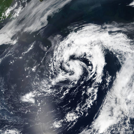
Satellite images, weather maps and tracks of Tropical Storm Ana 2021, May 19 - 24. Max wind speed 45mph.

Ana has mainly remained devoid of deep and organized convection today (May 23), with only a couple of short-lived bursts noted in satellite imagery earlier this morning (May 23). The cyclone has been an exposed cloud swirl through the afternoon and evening hours, and Ana continues moving into a hostile environment characterized by cool sea-surface temperatures, dry mid-level air, and increasing vertical wind shear. Thus, Ana has become a post-tropical cyclone, and this will be the final NHC advisory on the system.

Although a recent ASCAT-B pass missed the center of post-tropical Ana, it still shows an area of 30-35 knot winds in the southeast quadrant of the low near the edge of the swath. Therefore, the initial intensity is set at 40 mph (35 knots), with the slightly stronger winds likely just a product of the accelerating forward speed of the system. The post-tropical cyclone is embedded in deep-layer southwesterly flow and will continue to accelerate northeastward until it opens up into a trough and becomes absorbed by a strong baroclinic zone approaching from the northwest on Monday.

Additional information on post-tropical Ana can be found in High Seas Forecasts issued by the National Weather Service, under AWIPS header NFDHSFAT1, WMO header FZNT01 KWBC, and online at https://ocean.weather.gov/shtml/NFDHSFAT1.php

Forecaster Reinhart/Brown. Information provided by the National Hurricane Center (NHC).