Measure Distance

Measure Area

Click on the map to add points. Double‑click to finish.

Tap on the map to add points.

Tropical Cyclone Alfred 2025

Last Modified:
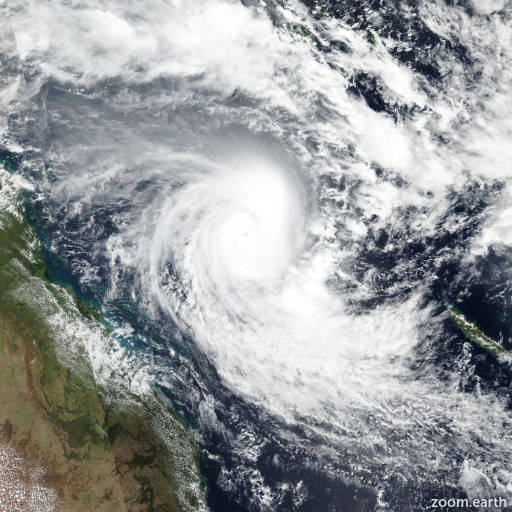
Cyclone Alfred

Live tracking map, satellite images and forecasts of Tropical Cyclone Alfred 2025 in the Coral Sea. Current wind speed 120km/h. Max 155km/h.

Alfred is located 520 km east-northeast of Willis Island, Australia, and has tracked southward at 6 km/h (3 knots) over the past 6 hours. Maximum significant wave height is 9.1 meters (30 feet).

Alfred will continue to track southward under the steering influence of the building near-equatorial ridge.

The favorable environment will fuel steady intensification to a peak of 155 km/h (85 knots) in 24 hours. Afterward, increasing wind shear will mainly be responsible for its gradual weakening down to 95 km/h (50 knots) in 5 days as it approaches the central east coast of Australia.

Forecast models are in overall good agreement with a gradual spread to 313 km in 3 days, lending medium confidence to this portion of the JTWC track forecast; then to a much wider spread of 774 km in 5 days, lending low confidence to the extended portion of the track forecast.