Extratropical Cyclone Indusa 2026
Last Modified:
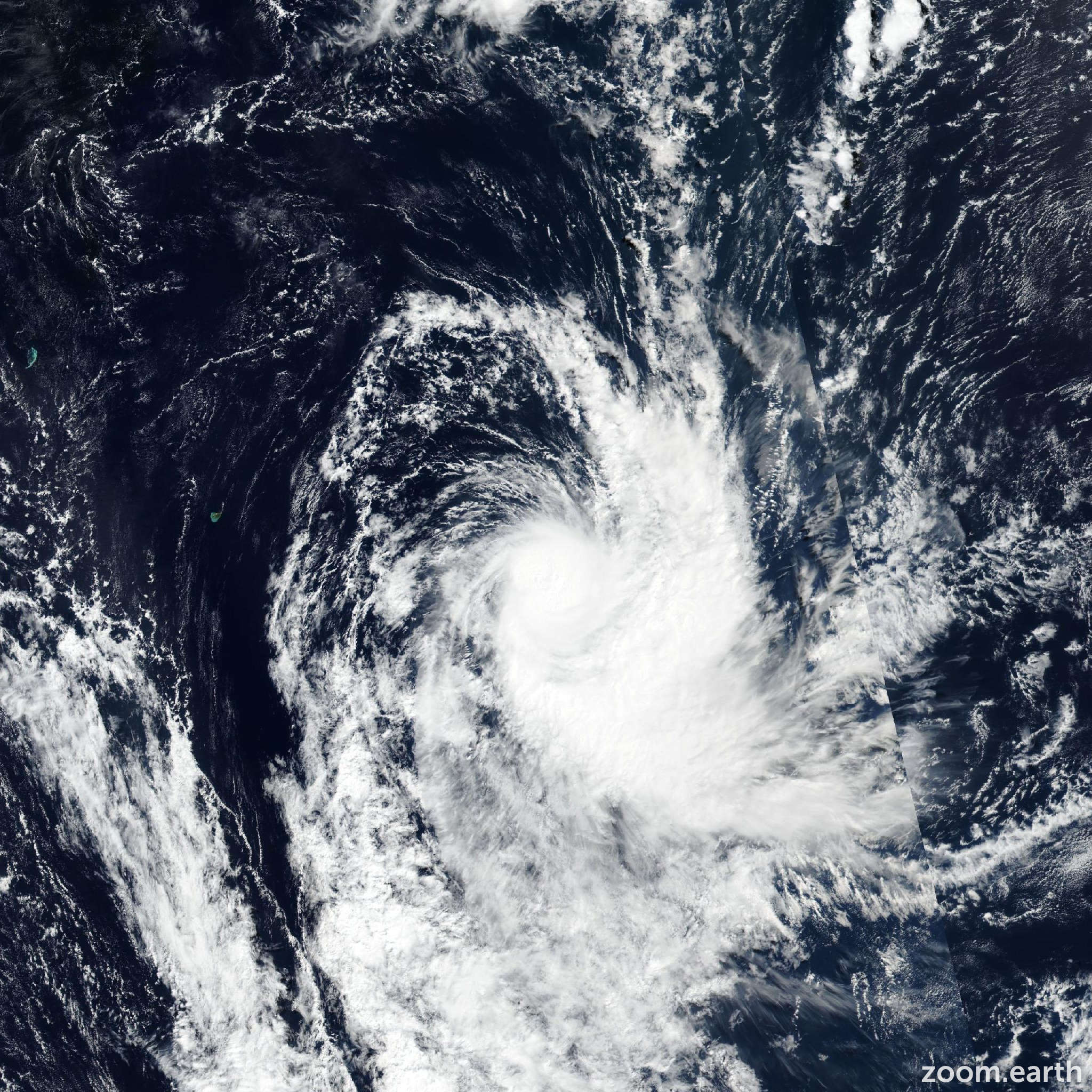
Live tracking map, satellite, radar, and forecasts of Extratropical Cyclone Indusa 2026 in the southwest Indian Ocean. Current wind speed 110km/h. Max 165km/h.
Indusa is located 1398 km east-southeast of Port Louis, Mauritius, and has tracked southward at 37 km/h (20 knots) over the past 6 hours. Maximum significant wave height is 8.8 meters (29 feet).
Indusa has rounded the ridge axis and started tracking south-southeastward in the past 6 hours under the steering influence of the subtropical ridge to the east.
It is forecast to accelerate on a south-southeastward track over the next 12 hours, then further accelerate on a more southeastward track over the next 24 hours as it interacts with a deep mid-latitude trough approaching from the west.
The steady weakening trend of Indusa will continue over the next 24 hours in response to the increasing wind shear and dry air entrainment associated with the mid-latitude trough.
The system is forecast to begin extratropical transition in around 12 hours as it enters cooler (less than 26°C) sea surface temperatures and becomes engulfed by dry air.
Transition to a warm-core seclusion type extratropical low will be complete in around 24 hours as sea surface temperatures drop below 24°C.
Model track guidance is in good agreement on the gently recurving track toward the southeast, with a cross-track spread of 130 km at 24 hours.
There are no significant outliers among the suite of models, lending high confidence to the JTWC track forecast, which is placed very close to the consensus mean.
The model intensity guidance agrees on steady weakening throughout the forecast period.
The JTWC intensity forecast is placed close to the multi-model consensus with high confidence.