Hurricane Gil 2025
Last Modified:
Live tracking map, satellite images and forecasts of Hurricane Gil 2025 in the eastern Pacific Ocean. Current wind speed 75mph. Max 80mph.
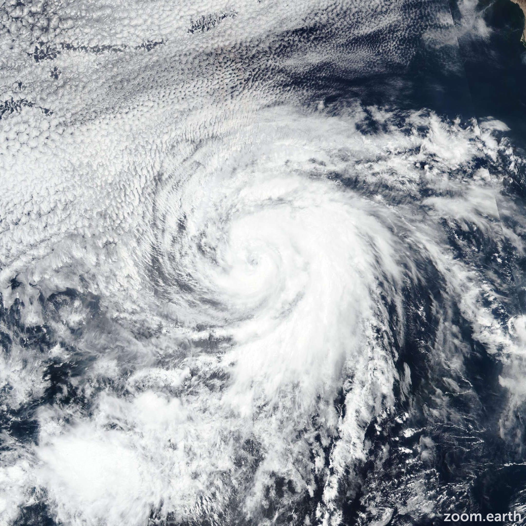
Gil appears to have rid itself of the intrusion of dry air it had been dealing with earlier in the day. The center is now embedded within a Central Dense Overcast, and as a result, subjective satellite estimates are a consensus T4.0/65 knots from TAFB and SAB. Several objective estimates from UW-CIMSS are at that level or higher, so Gil is therefore upgraded to a 65-knots hurricane.
Gil is moving faster toward the west-northwest, now 295/17 knots. Strong mid-level ridging is expected to persist to the north of the hurricane, which should cause Gil to continue moving quickly toward the west-northwest through much of the weekend. A slower forward motion with a turn toward the west is forecast by Monday as the weakening cyclone is steered by lower-level flow. The new NHC track forecast is just a touch south of the previous prediction, leaning toward the HCCA and AI models.
Gil only has a small window for continued strengthening since cooler sea surface temperatures lie ahead. The NHC intensity forecast allows for a bit more strengthening through 12 hours, but then fast weakening is expected thereafter due to the cold waters. In fact, model-simulated satellite images indicate Gil will likely lose its deep convection in about 48 hours, and the NHC forecast shows it becoming post-tropical at that time. Because of Gil's fast motion, the decrease in its winds are likely to lag the loss of convection, and the 45-knots forecast intensity at 48 hours is higher than is typical for when an eastern Pacific tropical cyclone becomes post-tropical. Gil is expected to open up into a trough by day 5, which is supported by most of the global model guidance.