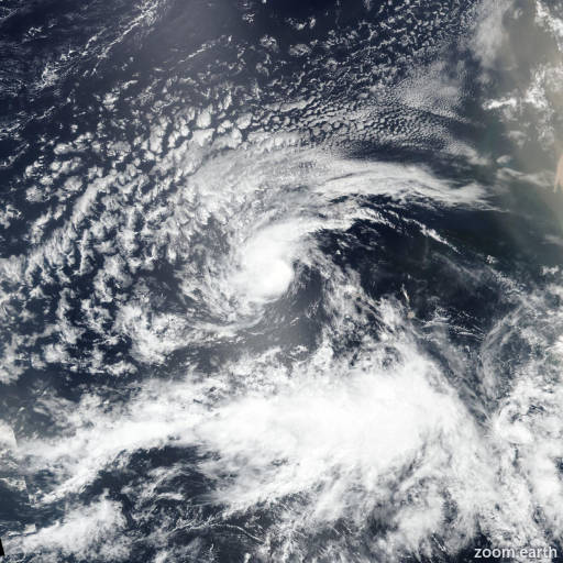
Tropical Storm Erin 2025
Last Modified:

Live tracking map, satellite images and forecasts of Tropical Storm Erin 2025 in the central Atlantic Ocean. Current wind speed 45mph. Max 115mph.
Although it is still too early to know exactly what impacts Erin might bring to the northern Leeward Islands, the Virgin Islands, and Puerto Rico, the risk has increased for Erin to move closer to these islands over the weekend. Interests there should monitor the progress of this storm.
There is even greater uncertainty in what impacts, if any, might occur in portions of the Greater Antilles, the Bahamas, the east coast of the United States, and Bermuda next week. As we approach the climatological peak of the hurricane season, this is an opportune time to ensure your preparedness plans are in place.
Erin still has a well-defined low-level circulation, but the convective pattern has degraded since overnight, with only a band of moderate convection located within the southern part of the circulation. A 12:26 UTC ASCAT-C pass showed a maximum wind barb of 40 mph (36 knots) north of the center, and the intensity is held at a possibly generous 45 mph (40 knots). Most likely, this is a result of Erin's fast motion, which has been south of due west (265 deg) at about 25 mph (20 knots).
The guidance suite indicates that Erin may continue to lose some latitude during the next 24 to 36 hours due to strong low- to mid-level ridging over the eastern and central Atlantic, but overall the general motion should be westward through early Thursday. After that time, indications are that the ridge may weaken over the western and central Atlantic, causing Erin to turn west-northwestward, but there are model discrepancies on when that might happen and where the break in the ridge actually forms. The trend has been for a weaker Erin in the short term and possibly a stronger ridge, and a number of track models, including HAFS-A and -B, HWRF, the European, HCCA, and the Google Deep Mind, have shifted south and west for much of the 5-day forecast. The NHC forecast has shifted in that direction accordingly, and it should be noted that a significant number of deterministic models and ensemble members still lie even farther south.
The environment of marginal water temperatures (26–27°C) and low atmospheric instability and moisture appear to remain nearly constant for the next 24 hours or so. Therefore, little to no intensification is expected through early Wednesday. The environment and water temperatures become much more suitable for strengthening by 48 hours, and since the cyclone already has a well-defined structure, it could become a hurricane by late Thursday. Continued strengthening is forecast after that time, and the NHC forecast continues to show Erin becoming a major hurricane by day 5 (early Sunday). There is quite a lot of spread in the intensity models, and the NHC prediction is in the upper regime of the envelope, close to the SHIPS model, Florida State Superensemble, and ICON intensity consensus.